 Alex Vejar
The storms that have hit Utah in recent weeks have brought inches and inches of snow to the valleys. But more importantly, they have positively contributed to the water the state will need when winter gives way to spring.
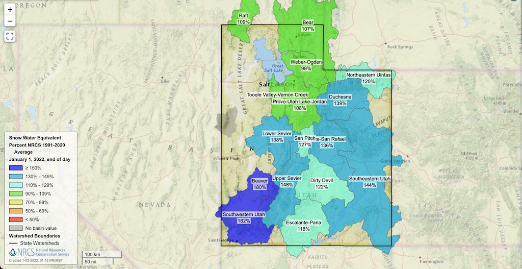
The snowpack across the state was above its normal levels on Saturday, according to the Utah Division of the Natural Resources Conservation Service. That’s a welcome sign for a state still experiencing a significant drought.
The most recent map of Utah from the NRCS shows the state is above 100% of its snowpack levels in most areas. For example, the area around Salt Lake City stands at 108% of its average.
Utah ski resorts could still use more snow. On Sunday, Park City Mountain Resort reported 29 of 43 lifts open and Snowbird said 11 of 13 lifts are running.
Alex is an expat from Los Angeles who started his journalism career in 2013 after attempting, and failing, to become the next great rock star. He most recently covered local sports in Chico.