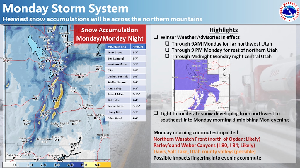
A snowstorm that snarled traffic in some areas of northern Utah will head out of the state Monday night — and another storm is coming this way Thursday.
According to the National Weather Service, northern Utah could see snow accumulations on Monday of 1 to 4 inches in the valleys and 5 to 10 inches in the mountains, where a winter weather advisory remains in effect until 9 p.m. Temperatures in the Salt Lake City area will remain below freezing, with a high near 27 and an overnight low of about 16.
The snow is expected to taper off after 8 p.m.
Tuesday will be partly sunny, with a high near 25 and an overnight low of about 19. Wednesday will be mostly cloudy, with a high near 31 and a low around 23.
And then another storm moves into northern Utah. There’s a 90% chance of snow Thursday, according to the weather service, and it could be heavy at times. Accumulations of 3 to 7 inches are possible in Salt Lake City. The forecast high is 30; the overnight low is 23.
There’s a slight chance of snow in southern Utah on Monday before 11 a.m. But then clear skies are expected throughout the week in the St. George area, with highs in the upper 40s and low 50s and lows in the upper 20s and low 30s.