Better air and a little bit of snow are headed to northern Utah, according to the National Weather Service.
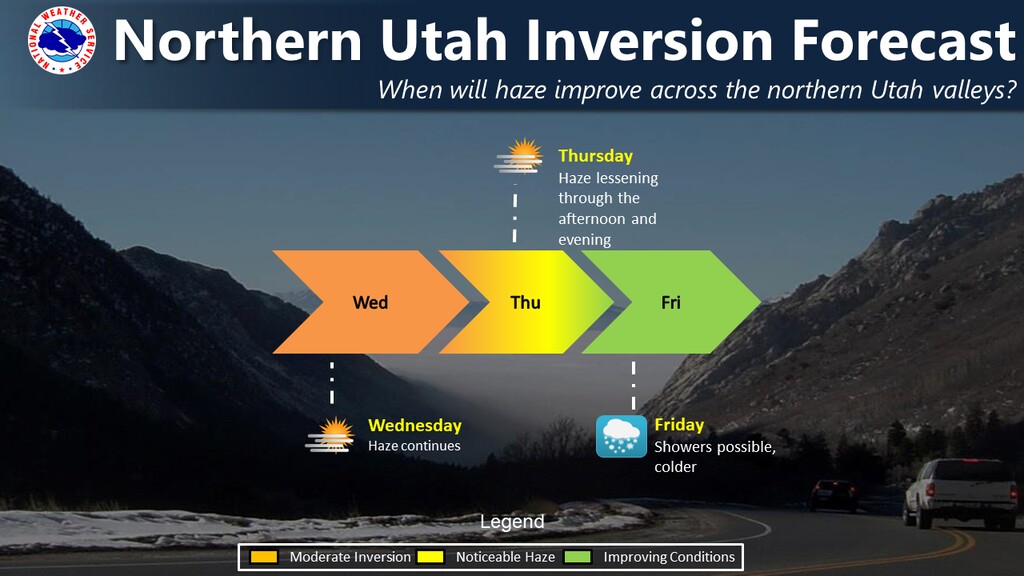
The forecast calls for a weak cold front to move through Wednesday night and begin to break up the inversion. No precipitation is expected, and valleys will remain hazy on Thursday.
But a second — and stronger — cold front is expected Thursday that will not only clear the air but drop some snow. There’s a 60% chance of snow showers on Friday, mostly after 11 a.m., with accumulations of less than an inch in the valleys. There’s a 20 percent chance of more snow on Saturday — and the possibility of still more snow Sunday through Tuesday, although no significant accumulation is expected.
After a forecast high of 42 on Wednesday, the Salt Lake City area won’t get out of the 30s through at least Tuesday, and it’s expected to be at or below freezing on Friday and Saturday. Overnight lows will be in the 20s.
Southern Utah may also get some precipitation, but only a bit. There’s a 20% chance of rain or snow on Friday morning before 11 a.m. in the St. George area. After highs of 61 on Wednesday and 58 on Thursday, St. George can expect highs from the upper 40s to the mid-50s through Tuesday, with overnight lows in the upper 20s and lower 30s.