Al Hartmann | The Salt Lake Tribune
Wetlands and autumn leaves in full splendor at Silver Lake in Big Cottonwood Canyon Sunday S
Al Hartmann | The Salt Lake Tribune
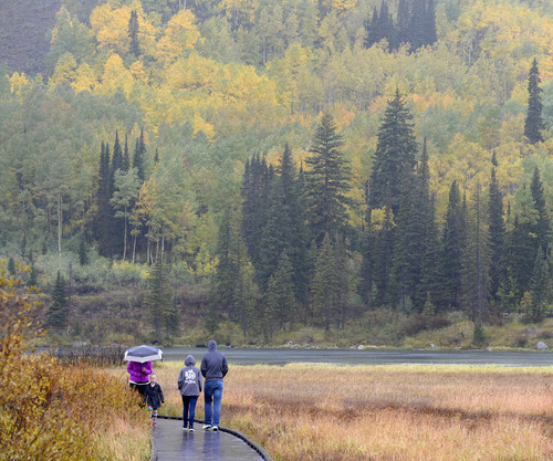
People brave a cold rain Sunday September 21 to see the autumn leaves in full splendor at Si
Al Hartmann | The Salt Lake Tribune
Fisherman braves a cold rain Sunday September 21 sharing the autumn leaves in full splendor
Al Hartmann | The Salt Lake Tribune
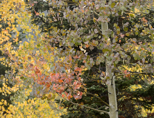
Aspen leaves in full splendor at Silver Lake in Big Cottonwood Canyon Sunday September 21.
Al Hartmann | The Salt Lake Tribune
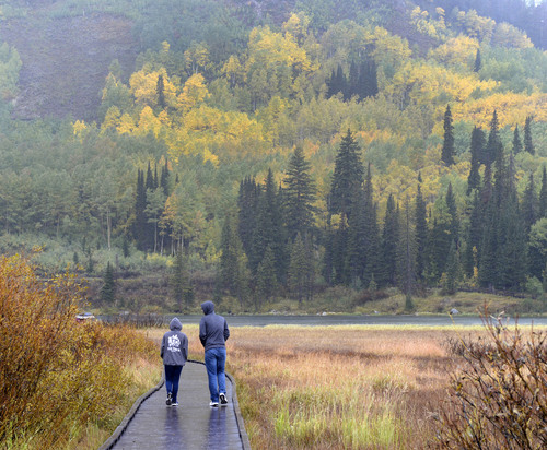
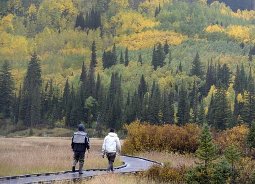
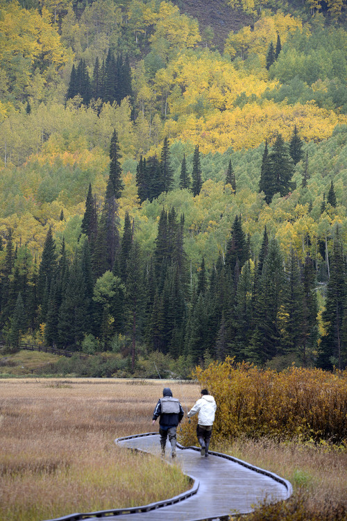
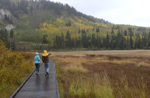
Fishermen walk the boardwalk in a cold rain to Silver Lake in Big Cottonwood Canyon Sunday S
Al Hartmann | The Salt Lake Tribune
Fishermen walk the boardwalk in a cold rain to Silver Lake in Big Cottonwood Canyon Sunday S
Al Hartmann | The Salt Lake Tribune
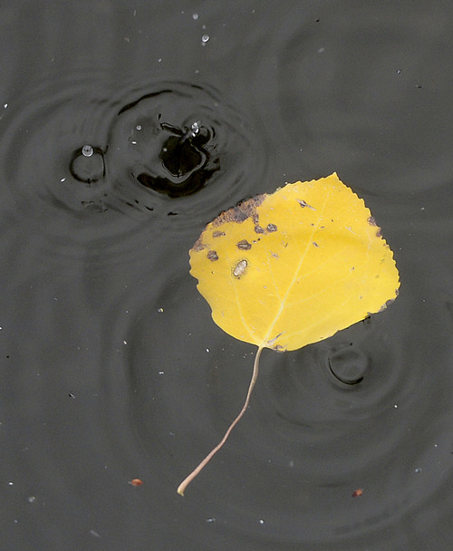
Hard rain falls on Silver Lake and Aspen leaf in Big Cottonwood Canyon Sunday September 21.
Al Hartmann | The Salt Lake Tribune
Fisherman braves a cold rain Sunday September 21 sharing the autumn leaves in full splendor
Al Hartmann | The Salt Lake Tribune
People brave a cold rain Sunday September 21 to see the autumn leaves in full splendor at Si
Al Hartmann | The Salt Lake Tribune
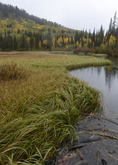
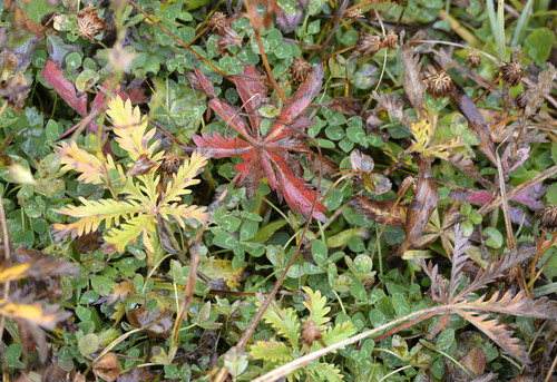
Ground coverplants turning colors at Silver Lake in Big Cottonwood Canyon Sunday September 2
Al Hartmann | The Salt Lake Tribune
People brave a cold rain Sunday September 21 to see the autumn leaves in full splendor at Si
Al Hartmann | The Salt Lake Tribune
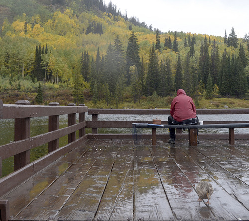
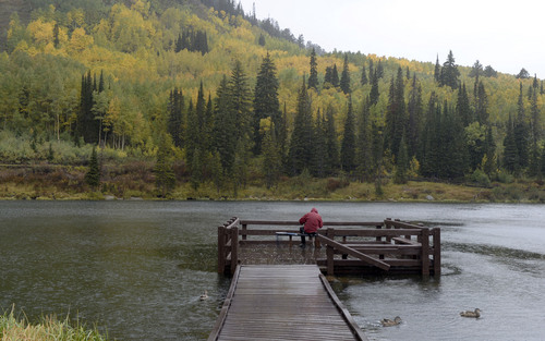
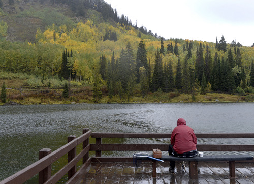
Fisherman braves a cold rain Sunday September 21 at Silver Lake in Big Cottonwood Canyon. F
Al Hartmann | The Salt Lake Tribune
Wetlands and autumn leaves in full splendor at Silver Lake in Big Cottonwood Canyon Sunday September 21.
Al Hartmann | The Salt Lake Tribune
People brave a cold rain Sunday September 21 to see the autumn leaves in full splendor at Silver Lake in Big Cottonwood Canyon
Al Hartmann | The Salt Lake Tribune
Fisherman braves a cold rain Sunday September 21 sharing the autumn leaves in full splendor with a duck at Silver Lake in Big Cottonwood Canyon.
Al Hartmann | The Salt Lake Tribune
Aspen leaves in full splendor at Silver Lake in Big Cottonwood Canyon Sunday September 21.
Al Hartmann | The Salt Lake Tribune
Fishermen walk the boardwalk in a cold rain to Silver Lake in Big Cottonwood Canyon Sunday September 21.
Al Hartmann | The Salt Lake Tribune
Fishermen walk the boardwalk in a cold rain to Silver Lake in Big Cottonwood Canyon Sunday September 21.
Al Hartmann | The Salt Lake Tribune
Hard rain falls on Silver Lake and Aspen leaf in Big Cottonwood Canyon Sunday September 21.
Al Hartmann | The Salt Lake Tribune
Fisherman braves a cold rain Sunday September 21 sharing the autumn leaves in full splendor with ducks at Silver Lake in Big Cottonwood Canyon
Al Hartmann | The Salt Lake Tribune
People brave a cold rain Sunday September 21 to see the autumn leaves in full splendor at Silver Lake in Big Cottonwood Canyon
Al Hartmann | The Salt Lake Tribune
Ground coverplants turning colors at Silver Lake in Big Cottonwood Canyon Sunday September 21.
Al Hartmann | The Salt Lake Tribune
People brave a cold rain Sunday September 21 to see the autumn leaves in full splendor at Silver Lake in Big Cottonwood Canyon
Al Hartmann | The Salt Lake Tribune
Fisherman braves a cold rain Sunday September 21 at Silver Lake in Big Cottonwood Canyon. Fishing was slow but the fall colors made up for it.