


This is an archived article that was published on sltrib.com in 2016, and information in the article may be outdated. It is provided only for personal research purposes and may not be reprinted.
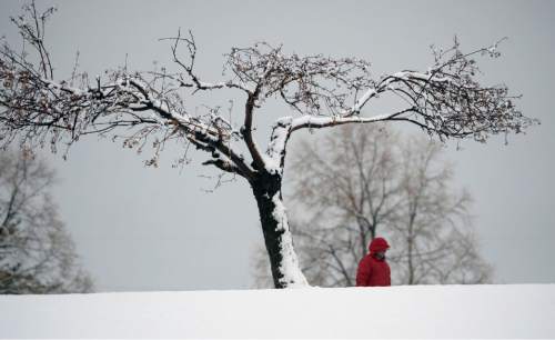
Spring came in like a lamb, but on Tuesday it morphed into a bellowing, frosty lion as temperatures dipped more than 20 degrees while first rain and then heavy snow pelted the Wasatch Front.
After Monday's highs rose into the upper-60s in northern Utah and the 70s along the state's southern borders, Tuesday's forecast called for daytime highs in the mid- to upper-30s along the Wasatch Range, while Utah's Dixie retreated into the 40s and 50s.
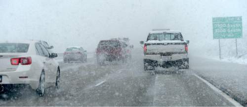
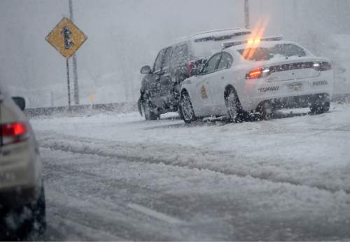
A Winter Weather Advisory was in effect through noon Wednesday for a swath of Utah extending south from Logan and Brigham City through Ogden, Salt Lake City, Park City, Provo, Nephi and Richfield, and east to Vernal. The National Weather Service predicted 8-14 inches of new snowfall in the Wasatch and Uinta mountains, while a rain turning to snow fell on the region's benches and valleys.
Gusty winds, rising from 10-20 mph to 30 mph or more in places, also were on tap for most of the state.
The sudden icy onslaught had Utah Highway Patrol troopers rushing to the scenes of nearly 50 crashes and slideoffs between 6 a.m. and noon. None of those accidents involved serious injuries, UHP Sgt. Todd Royce said.
Salt Lake Valley police dispatchers, meanwhile, reported another two-dozen collisions during the storm's heaviest hours Tuesday morning.
Wednesday's forecast was for resumed morning snow showers turning to rain later in the day in the Salt Lake and Tooele valleys, with high temperatures in the upper-40s.
Southern Utahns, though, will see sunny skies and highs in the upper-60s on Wednesday.
As of Tuesday morning, the Utah Avalanche Center rated the risk for potentially deadly backcountry snowslides at "moderate" for the state's northern, central and eastern mountains, while the Moab and Abajo peaks were graded as "low" for avalanche danger.
The Utah Division of Air Quality gave "green," or healthy designations for all the state's monitoring districts through the midweek.
For more extensive forecast information, visit The Salt Lake Tribune's weather page at: http://www.sltrib.com/news/weather/.
Twitter: @remims