


This is an archived article that was published on sltrib.com in 2015, and information in the article may be outdated. It is provided only for personal research purposes and may not be reprinted.
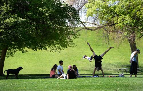
Spring has definitely arrived in Utah.
The temperature at Salt Lake City International Airport hit 81 degrees Saturday afternoon, the warmest so far this year, but 10 degrees shy of the record for May 2, the National Weather Service said.
The weather service is predicting a mild weekend all along the Wasatch Front, with highs in the 70s and 80s on Saturday and temperatures dipping to the 40s and 50s overnight.
Skies will be partly cloudy Saturday and there is a slight chance of rain and thunderstorms throughout the day in northern Utah.
Sunday will be a little cooler, according to the weather service, and the slight chance of precipitation will continue. The thermometer is expected to hit the upper 60s to the 70s. Nighttime lows will be in the 40s and 50 in many locations and drop to the 30s in the higher elevations.
In St. George, the high on Saturday could reach 90 degrees and Sunday's top temperature is expected to be in the mid 80s. Lows both nights are predicted to be in the 50s. There is a chance of showers and thunderstorms Saturday morning.
The Utah Division of Air Quality is predicting the air quality will be good, or healthy for breathing, in Cache, Tooele and Utah counties on Saturday and Sunday.
The outlook isn't quite as good for other counties — Salt Lake, Box Elder, Carbon, Davis, Duchesne, Uintah, Washington and Weber — where the air quality is rated one step lower, at moderate.
For more detailed weather information, visit The Tribune's weather page at http://www.sltrib.com/weather.
Twitter: PamelaMansonSLC