Para leer este artículo en español, haz clic aquí.
What lands in the mountains, must come down to the valleys.
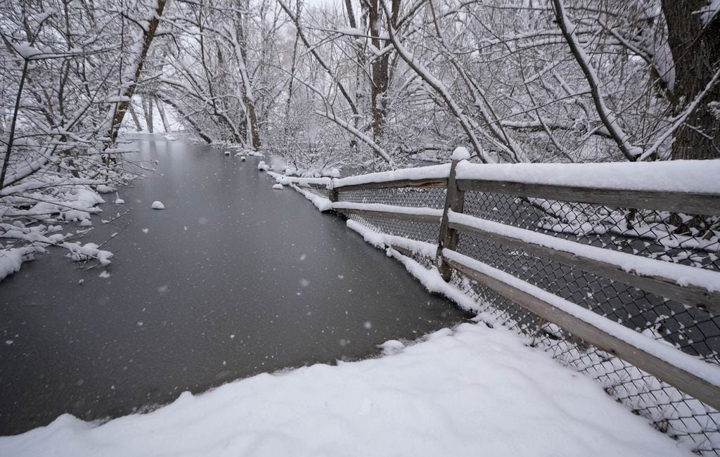
Utahns around the state are preparing for an enormous spring runoff after a historic, record-breaking snowpack has blanketed mountains across Utah. State and local officials are bracing for the worst, as the U.S. Department of Agriculture projects there are more than 27 inches of water in this year’s snowpack.
For perspective, Utah had around 11 inches of water last winter, and a little over 24 inches in 1983, when the spring runoff caused widespread flooding.
Water managers and emergency officials throughout Utah agree: A slowly warming spring is key to avoiding flooding.
Ideally, temperatures in the mountains would warm to above freezing during the day — allowing snow to melt off into valleys, rivers and reservoirs — before dropping below freezing at night. The nightly freeze would slow the runoff, allowing a more drawn-out release of water over time.
A worst-case scenario would be temperatures jumping into summertime levels all at once during the late spring. That situation played out in 1983, when flooding turned State Street into a makeshift river, and mudslides consumed a town, highway and railroad in Spanish Fork Canyon, in addition to causing slides in Davis and Sanpete counties.
Clint Mecham, Salt Lake County’s emergency management director, said for an ideal spring runoff, rain and snow would also have to stop falling. No matter how much preparation can be done, there are only so many safeguards that can be put in place.
“We’re really kind of dependent on Mother Nature, on how she decides she’s going to get us into those summer months,” Mecham told The Salt Lake Tribune. “Are we going to have a nice gradual warmup with cooled evenings, or is it just gonna get hot all at once?”
More snow stories


But there’s also a drawback to having the snowpack melt slowly, according to Jordan Clayton, supervisor for the Utah Snow Survey.
“If the snow melt gets spread out over a really long period of time, we are going to lose a percentage of that water relative to if that melt happens over a short period of time,” Clayton said. “When you’re melting all this snow in a rapid period of time, your flood risk is much higher, so obviously, flooding is a concern.”
Utah’s forecast? Expect it to stay cold
Current forecasts show the weather likely won’t feel like spring any time soon.
Linda Cheng, a meteorologist for the National Weather Service in Salt Lake, said forecasts show another storm rolling through Utah starting Sunday night and potentially lasting until the middle of the week.
As of March 28, all regions of the state have extraordinary snowpack as measured in snow-water equivalent, and several areas have more than 200 percent of the 30-year median.
“That’s going to be another statewide storm, with cold temperatures down through most valley floors, except for the St. George area,” Cheng said.
Cheng added that forecasts show temperatures will warm slightly in the coming days, but the weather isn’t expected to warm to typical springtime temperatures.
Southern Utah’s runoff
Washington County has already seen the Santa Clara and Virgin rivers reach flood stage, according to Jason Whipple, the county’s director of emergency services. Central Utah has also seen flows above flood stage, with flooding being recorded along the Sevier River already this spring.
Whipple said Washington County’s runoff in recent weeks caused damage to trails and a few remote dirt roads, but no damage to critical infrastructure. He added debris from rivers spilled over onto golf courses, which line the two main rivers.
An ideal spring runoff down south is the same as any other place in the state: nice and slow. Whipple said gradually warm temperatures would allow snow to melt from the bottom up — meaning snow in lower elevations would melt into rivers before moving to mid-level elevation snow and then high-altitude snow.
“If we could get it to warm up at a gradual rate, that would be perfect,” Whipple said.
The less-than-ideal runoff scenario would be high temperatures kicking in immediately. An even worse situation would be if rain were to fall on existing snow, “especially at the mid-level and the higher (elevations), that’s when we’re gonna get a lot of runoff really, really quickly,” Whipple said.
(Mark Eddington | The Salt Lake Tribune) Gunlock Falls overflows the boundaries of the Gunlock Reservoir northwest of St. George, Monday, March 20, 2023.
Cache County
Snow has stayed on the valley ground in parts of northern Utah, especially the backside of the Wasatch — places like the Ogden Valley and Morgan County.
That’s also true for Cache County, despite a handful of warm days recently. Snow in the surrounding mountains hasn’t melted at all, according to Cache Water District manager Nathan Daugs. He told The Tribune in March that basements in Logan have started to flood, which he thinks will continue as the runoff drags on.
He’s also hoping for an end to the rain.
“If we can turn the moisture off for a little while as it warms up, and start to break some of that snow melt down without the extra rain in the valley on top of it — that would be the ideal situation for flooding purposes,” Daugs said.
A place like Cache Valley only has so many places for water to go, with only Cutler Reservoir to the west and Porcupine and Hyrum reservoirs to the south to soak up the runoff.
“Places like Cache County are looking at hopefully a slow warm up, because if it all happens really quickly, all that valley snow is going to not really have anywhere to go but in people’s yards,” said Jordan Clayton, supervisor for the Utah Snow Survey.
Elsewhere in Utah
As with other areas of the state, much of northern Utah’s spring runoff is still trapped in higher elevations. Scott Paxman, general manager for the Weber Basin Water Conservancy District, said snow in higher elevations hasn’t started to move.
Paxman thinks that snow could start coming down in mid-April, and peak runoff flows likely won’t happen until mid-May. Regardless, the district has been releasing water from its reservoirs to make room for the impending runoff, no matter how quickly it arrives.
Like other water managers, Paxman said, “those warmer (then) cooler cycles really help bring it down and in handleable volumes, so it doesn’t all come down at once.”
Mecham, the emergency management director for Salt Lake, said the area’s runoff in normal years starts in late April or the first part of May. He added the areas of concern during the runoff will be the county’s many creeks, as Salt Lake officials have previously said Big Cottonwood and Little Cottonwood creeks are particular spots they’re focusing on.
“We’re looking at, literally, a record year for snow water equivalent and snowpack up in the mountains above Salt Lake County,” he said.
“There’s a lot of water up there, and at some point, it’s going to need to come down.”
