


This is an archived article that was published on sltrib.com in 2016, and information in the article may be outdated. It is provided only for personal research purposes and may not be reprinted.
Moab • Several years ago a group of mountain bikers were working their way up the Klondike Bluffs trail near here when a jeep came chugging from behind the group. Backed by some of the most amazing scenery in Utah, spoiled only by the noise and smell of the jeep, the driver leaned out and casually asked, "Is this all there is up here?"
Stunned, the only reply I could think of was "What else do you want? A McDonald's?!"
It was at that moment I yearned for more non-motorized trails in the so-called mountain biking capital of the world. To be sure, the trails that made Moab what it is — Slick Rock, Amasa Back, Porcupine Rim and the other classics — were and still are fantastic.
Many of the classic trails were first carved out by dirt bikes, so they deserve a nod for being trail blazers.
But there are times when one just wants to get away from the crowds and noise and just enjoy the desert on a lone piece of slick rock.
To that end, thank goodness for the Moab Trail Alliance and Grand County Trail Mix Committee. Together, they have overseen the creation of some of the most flowy, luscious single track in the West. The Mag 7 area, the expanded Klondike Bluff trails and others are part of the efforts, giving mountain bikers (and hikers, if you wanted to do that kind of thing) a respite from the trails frequented by large crowds and motorized vehicles.
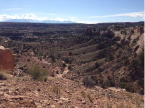
The systems are so extensive it's possible to ride for several miles without seeing another biker — even in the thick of Moab's high season.
Recently we explored one of the group's latest creations, Navajo Rocks.
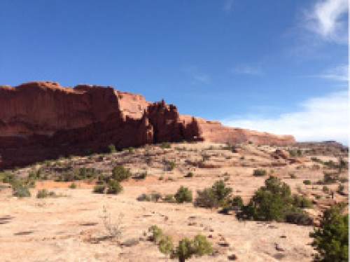
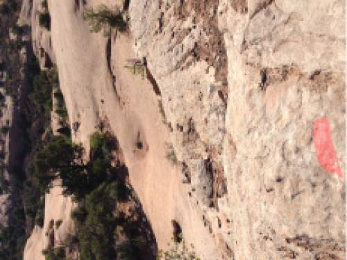
Located off Hwy 313, the system includes almost 18 miles trails that can be ridden as one big ride or broken into segments. Just like the other trails created by the group, the trails are mapped well and marked with bright paint.
It's nice to have a map with you, especially since proceeds fund the trail building, but it's also comforting to know you can strike out on new territory without the fear of getting lost and suffering through your own episode of "Survivor."
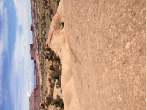
The loops offer a variety of territory, from smooth slick rock, to techy ledgey fun to sweet desert single track.
The loops can be ridden in either direction, but here are our preferred routes:
• Park at the trail head located approximately 7.2 miles up 313 to the right side of the road.
• Start out on the 3.2 mile Rambler trail, a great cruising ride that will warm up your legs to the slick rock and the fantastic views.
• Don't spend too much time looking up though, this trail does have a few techy spots. Short steep areas, tight turns and a few ledges will challenge intermediate riders but they aren't frequent enough to make the ride too much for inexperienced riders.
• At the bottom of Rambler, cross the road and work your way up Rocky Tops, a 4.5 mile section that has some amazing slick rock pieces that will have you giggling.
• Rocky Tops eventually meets two other trails, Coney Islands and 7-Up.
• The 7-Up option is a .8 connector that will take you to the Mag 7 trailhead and that playground.
• For those wanting to stick in the immediate area, take Coney Islands for a short stint until it meets with a .5-mile trail called "Middle Earth."
Here, you have the option of continuing up Coney Island, or taking Middle Earth back to the parking lot. We prefer the latter, since it's a convenient way to stop and refill water bottles, refuel or just call it a day.
Chances are, though, you are going to want to explore some more before putting the bike away. Do so by taking Big Mesa, a fun 3.3-mile trail with yet more jaw dropping views.
This section of the trail system rides faster than the others, thanks to long, smooth sections through desert. Soon you pop out to another section called "The Big Lonely." This 3.1-mile trail takes you out into some lonely sections, save for the occasional biker or the few cows grazing below the trail.
Give them a nod as you rip along the edge of a trail that skirts a canyon.
Eventually you will connect to Coney Islands, a 3.0-mile trail that will give you a great descent if ridden from Big Lonely. Otherwise it will be a climb, but certainly not an impossible one.
Once you get to the Middle Earth/Rocky Tops section you can decide whether to make it back to the parking lot or hammer around in the opposite direction.
Either way you can't go wrong. Just remember, if anyone asks if this is "all it is," just say "yes." It's all we need. —
Navajo Trails Overview
• An almost 18-mile section of intermediate/advanced trails located on Hwy 313 (the road to Canyonlands and Dead Horse Point).
• It can be connected with the Mag 7 trail system or ridden by itself.
• Trails feature a variety of slick rock options, desert riding and technical ledges.
• The trails are well marked, but buy a map and support the trail alliance groups.