


This is an archived article that was published on sltrib.com in 2014, and information in the article may be outdated. It is provided only for personal research purposes and may not be reprinted.
It's hiding in plain sight.
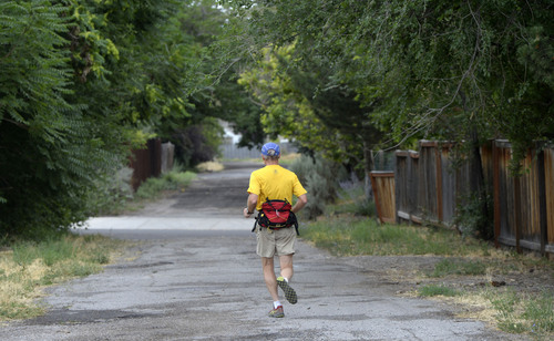
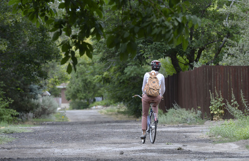
What looks in many spots to be an alleyway will become a bicycle and pedestrian route called the McClelland Trail from Brickyard Plaza at 3300 South to 800 South at McClelland Avenue.
The alignment is that of the 132-year-old Jordan-Salt Lake City Canal, which wiggles for 28 miles along the east side of Salt Lake Valley from the Jordan Narrows to South Temple, where it connects with City Creek at Eagle Gate.
"At the time, it was a feat of engineering," said Jeff Niermeyer, director of public utilities for Salt Lake City. Today, it remains a "very significant" part of the municipal water system.
It was originally contemplated that mule-drawn barges would haul granite blocks on the canal from Little Cottonwood Canyon to the Salt Lake City LDS Temple. But the three-year construction didn't begin until 1879. And, in 1914, the waterway was covered when the city replaced the original canal with a concrete conduit.
Now — a century later — Salt Lake City plans to improve the route that meanders north and south through neighborhoods between 1000 East and 1200 East. Recently, the City Council allocated $1 million for the work, which is tentatively scheduled to begin next spring.
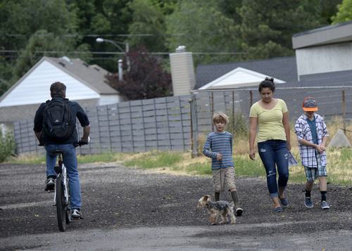
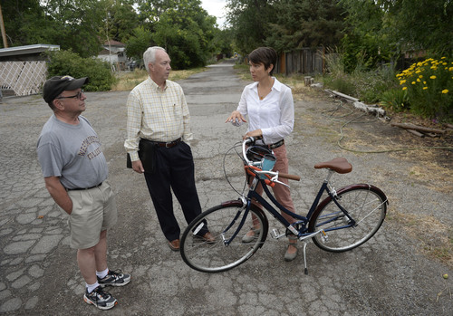
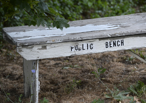
Among the champions of the McClelland Trail is City Councilwoman Erin Mendenhall, who pushed for funding improvements. She noted the route — lined with fruit trees in some places — has something of a serendipity feel about it. Most Salt Lakers don't know it exists and are delighted when they stumble upon it.
"It's a shame we covered up all our waterways 100 years ago," she said. "But we still have the canal that can never be built upon. It provides a protective corridor and gives us a humongous amount of trail."
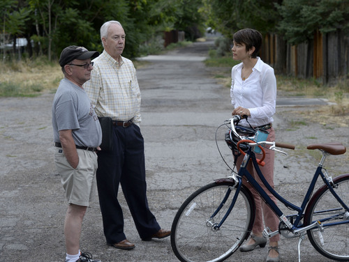
Improving the canal route has been on the minds of community activists for years, according to Michael Cohn and Darryl High, co-chairmen of the East Liberty Park Community Organization.
"This is potentially one of the most charming and delightful places on the east side," Cohn said. "We see it as open space and a transportation corridor. It has a lot of potential value."
But the route has languished, High said, and many residents don't feel comfortable there at night.
"Our dream is that it would be a corridor where people would like to come," he said. "Where neighbors would be proud to live nearby, instead of worrying that something [dangerous or illegal] is going on."
The route will be a nice addition to the city's growing bicycle grid, said Robin Hutcheson, the city's transportation director. Among other things, it will connect to the east-west S Line, the Sugar House Streetcar route that also is part of the Parleys Trail system.
"It will be a quiet and safe place for bicyclists. It's a low-stress route," Hutcheson said. "It's a beautiful place to walk and connect with neighbors."
But Cohn and High concede not all neighbors may embrace the change from alley to bikeway. The 66-foot-wide canal has been used for years as access to private property. Some homeowners abutting the canal may not like a lot of new bicycle and pedestrian traffic passing by. And in some cases, property owners have — perhaps unknowingly — encroached upon the right of way and may have to make adjustments.
"We have a lot of work to do," Mendenhall said of public outreach on the matter. "A lot of neighbors don't even know it's a canal. They think it's an alley."