

This is an archived article that was published on sltrib.com in 2011, and information in the article may be outdated. It is provided only for personal research purposes and may not be reprinted.
After a flood of 6,000 comments from residents worried that the proposed northward expansion of the Legacy Parkway would destroy homes, hurt farming and divide communities, the Utah Department of Transportation on Thursday released tweaks to its plan that it says would lessen impacts.
Refined plans now would take 69 homes, instead of up to 137 under earlier proposals for the $485 million West Davis Corridor. To help farms, proposed alignments were changed to run along the edge of some of them or leave large, farmable fields on both sides of the road.
And to help avoid wetland impacts and other environmental concerns, UDOT eliminated one of its three earlier alternatives that went through the far-west portion of Syracuse. Randy Jefferies, project manager, said that alternative also did not help traffic as much as other alternatives.
But not everyone is happy. Owners of homes and farms still in the path of the road are upset, and environmental groups worry the highway would accelerate development and air pollution — and may hurt wetlands and wildlife.
While Dorothy Law, of Black Island Farms in Syracuse, has not yet seen the latest alignments, she vowed Thursday to continue fighting to preserve her family's 52-year-old business.
"They're destroying my farm," Law said of the agency's plans to bisect a portion of her family's 350-acre property. "When you cut a vegetable field in half, there are watering and accessibility issues."
UDOT says the highway would affect up to 232 acres of prime farmland. Jefferies said tweaks were made to the possible routes to push them "to the edges of farms or to make sure we have large areas for farming on either edge of the alignment."
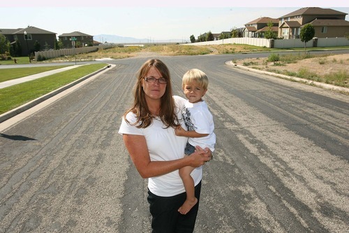
For several months, Steven and Christine Peck have rallied hundreds of neighbors in the Hunter Creek and Quail Crossing subdivisions in west Farmington and Kaysville to fight the highway that would divide their community and take out 10 homes.
"It will be in my backyard," Christine Peck said of UDOT's Shepard Lane alignment. "I could probably throw a rock and hit a car."
On Friday, Kaysville Mayor Steve Hiatt and Sen. Stuart Adams, R-Layton, will meet with residents about the latest alignments. That session starts at 7 p.m. at 2230 S. 350 East in Kaysville.
Hiatt gives UDOT credit for heeding homeowner concerns along Kaysville's Viewcrest Lane and taking the alignment farther west to save 17 homes.
Hiatt worries about two alternatives to connect the corridor with the current Legacy Parkway, one at Glovers Lane and another at Shepard Lane. The Shepard Lane alternative would now remove 12 homes instead of 10, Hiatt said, while the Glovers Lane route would affect 10 acres of wetlands but no homes.
"I am hopeful and optimistic that we can work with the organizations to come up with a happy consensus," Hiatt said. "But I am adamant that the obvious choice is Glovers Lane."
Meanwhile, Tim Wagner, southwest organizer for the Sierra Club, warns that the highway itself could spur more growth and pollution.
He said alternatives are "very concerning because they are putting the emphasis on building more roads to accommodate more land-use development." He said he would like to see more mass transit instead.
Jefferies said UDOT has proposed studying possible bus rapid transit — sort of a TRAX on rubber wheels — on key streets in the west Davis area, but not along the West Davis Corridor itself.
Wagner called that a step in the right direction, but worries that not enough east-west routes would be added to help connect to the FrontRunner rail system.
Wagner said the Sierra Club also is concerned about what current alternatives would do to wetlands.
"There still is a substantial impact to wetlands, and we need to look very closely at that," he said. UDOT estimates the new proposals would impact up to 137 acres of wetlands.
UDOT actually moved some road alignments into wetlands in some areas in its latest proposal to avoid tearing down some homes.
For example, Jefferies said that in west Kaysville, the wetlands were "not quite as large as originally thought, so that allowed us to shift [the highway] to the west side of the power corridor, avoiding the homes in west Kaysville."
Despite concerns, Jefferies said the highway is needed.
"The number of homes out here is going to double in western Davis and Weber counties in the next 30 years," he said. "With that growth comes the need for transportation. So the corridor is needed. The citizens of Davis and Weber counties are excited to see this corridor come."
Jefferies said UDOT hopes to have a draft Environmental Impact Statement completed next year and hold public hearings next summer. The agency hopes to have a final EIS in 2013. Detailed maps and plans are available at udot.utah.gov/westdavis.
No funding has been identified to build the highway. It is on long-range plans for when and if funding becomes available.
Jefferies also said the public-comment process has improved the project. "We have better alternatives now."
ldavidson@sltrib.comtcmckitrick@sltrib.comTwitter: @catmck —
More on the Web
Detailed maps and plans of the proposed northern stretch of Legacy Parkway are available at udot.utah.gov/westdavis.