


This is an archived article that was published on sltrib.com in 2014, and information in the article may be outdated. It is provided only for personal research purposes and may not be reprinted.
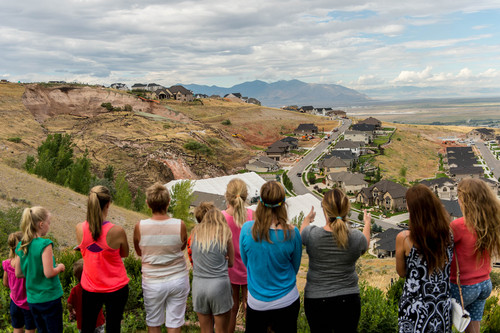
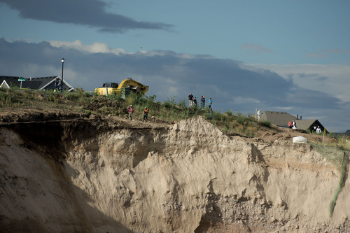
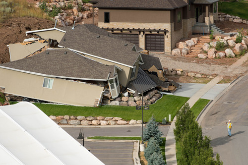
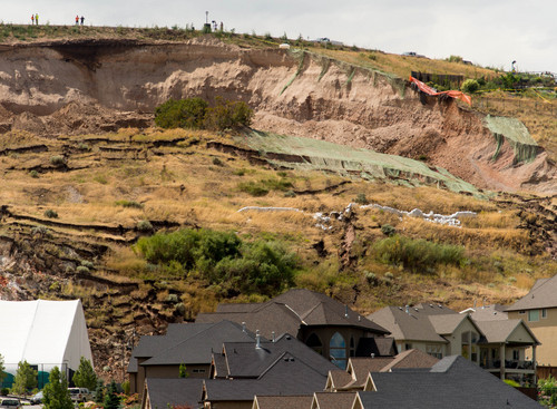
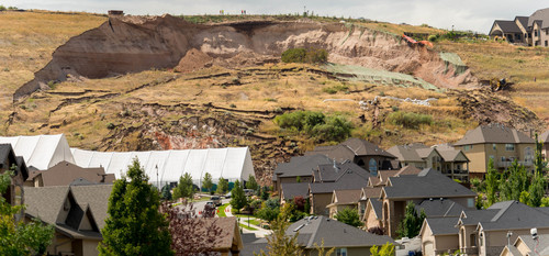
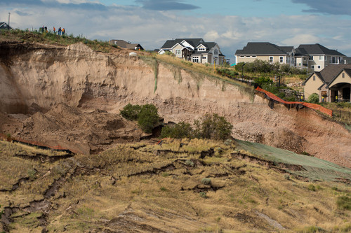
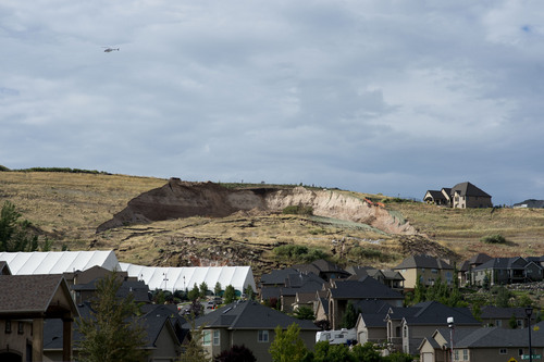
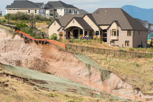
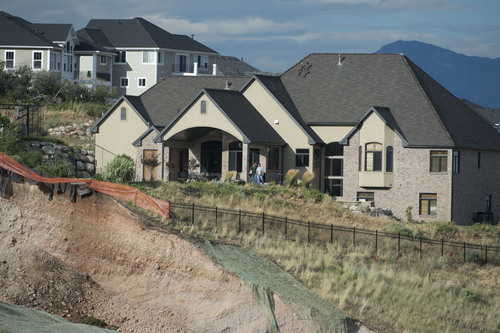
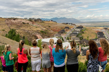
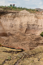
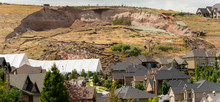
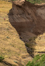
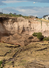
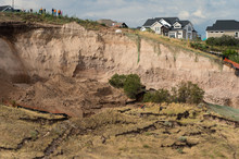
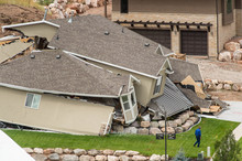
Heavy overnight rain triggered the North Salt Lake landslide that devastated one house and sent residents of more than 20 hillside homes fleeing for safety. Even in dry weather, however, the slope that collapsed Tuesday morning was weak and showing signs of danger.
"A large landslide like this will rarely fail catastrophically before giving some warning in advance," said Jeff Moore, a landslide expert in the geology and geophysics department at the University of Utah.
In the months leading up to the landslide, residents had complained of cracks in the top of the slope that collapsed. City officials had been monitoring for landslides by placing instruments designed to detect ground shifts into holes on the slope.
"You don't put in monitoring holes in a place where you don't suspect problems," said Utah Geological Survey deputy director Kimm Harty.
Even before the monitoring began, there were red flags.
"From a geological perspective, I would put a circle around this area and say, 'Watch out for landslides around here,' " said Joel Pederson, a geology professor at Utah State University.
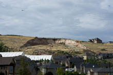
The slope had been used as a gravel quarry until the early 1990s, the developer Sky Properties said in a statement. When the property was excavated for development beginning in 1997, the slope was regraded and steepened from its natural state, making it prone to succumb to gravity, Pederson said.
The soil itself was also likely weak. Surveying a geological map, Moore noted that soil in the area is derived from volcanic deposits that turn to clay when repeatedly exposed to water. After looking at photographs of the landslide, Pederson also noticed fine-grain sediments from just below the shoreline of the prehistoric Lake Bonneville. Those sediments, Pederson said, are prone to sliding.
North Salt Lake City Councilman Conrad Jacobson called the slide a "tragedy" for the families involved but said there is little the city can do when developers provide geological reports attesting to the stability of land where they want to build.
"Any time we build on a hillside, there is concern," Jacobson said. "We required the developer [Sky Properties] to get a geotechnical test done on the hillside prior to development. They came back with a positive report."
In a statement issued Tuesday afternoon, Sky Properties said, "All earthwork in the development surrounding the slide has been performed based upon standard protocols, recommendations and approvals from several independent engineering companies as well as the geotechnical engineers representing North Salt Lake."
Sky Properties also has provided housing for several of the affected families while it works with the city to determine the cause of the landslide, the statement said.
North Salt Lake officials will look at ways to prevent similar events from occurring again, Jacobson said.
"I don't know how we could have predicted or prevented something like this," he said. "We're grasping at straws as to what more we could do and how we face the future."
In 1998, the Springhill slide forced the evacuation of one home that was destroyed. But Jacobson noted that event was much different. Springhill was of long duration — the land moved about an inch a year. The slide near Parkway Drive in the Eaglewood development was more of a surface-level event, he said.
Catastrophic landslides are generally difficult to predict because they are caused by processes that occur underground.
"There's no reason to suggest that city officials are anything except believable for saying they were caught by surprise by this," Pederson said. "And, of course, hindsight is 20-20."
Pederson and Moore said residents should remain wary of additional landslides in the surrounding area, especially with more rain expected.
Tribune reporter Christopher Smart contributed to this report.
Twitter: @Harry_Stevens