


This is an archived article that was published on sltrib.com in 2013, and information in the article may be outdated. It is provided only for personal research purposes and may not be reprinted.
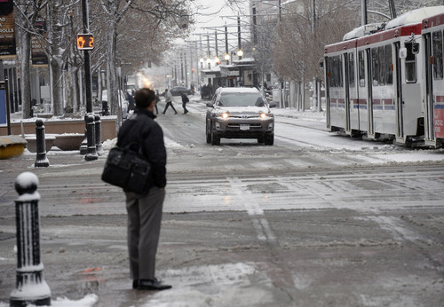
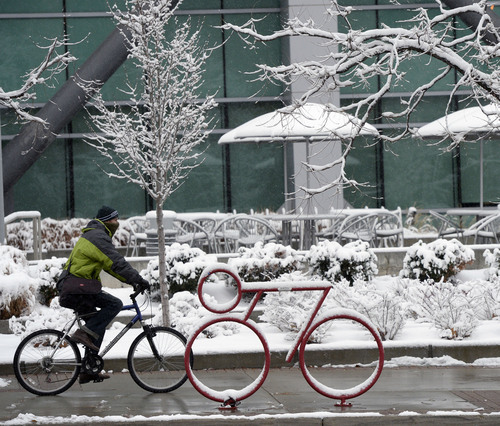
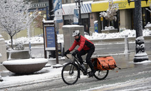
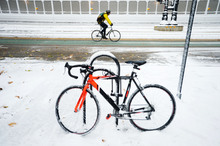
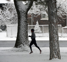
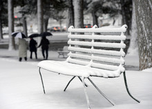
Southern Utah was bracing for the brunt of a statewide snowstorm Tuesday night, while farther north, snowfalls broke records.
As of 7:30 p.m., 89-year-old records were broken in Utah County. Snow in Provo measured 8.5 inches, more than doubling the old record of 4 inches, set for the date in 1924. In Spanish Fork, 10 inches of snow fell, beating the 1924 record of 7 inches.
The record for Dec. 3 also was broken in Salt Lake City, where 5.8 inches fell Salt Lake City International Airport, breaking a record of 3.5 inches, set in 1999.
And the snow still was falling Tuesday night.
Southern and Central Utah, up to the Utah Valley, were getting the worst of the storm.
"It's getting crazy," said Lesa Bezanson, clerk at the Southcreek Shell station in Beaver, as motorists took refuge from blowing snow about 9 p.m. "I wouldn't want to be on the roads right now."
St. George resident Tony Gongaware had ducked into the Shell station after his windshield wipers failed during a drive to Salt Lake City with his wife and two children — ages 1 and 3. It had taken 3 hours to get from St. George to Beaver, he said.
"It's just cold and constant snow," he said. "You try to follow a snow plow or a semi truck."
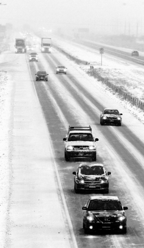
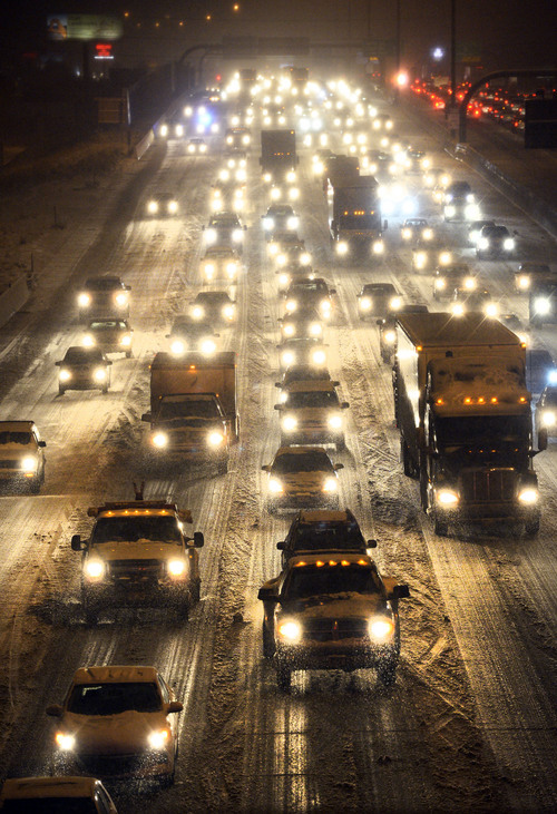
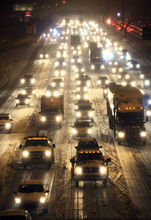
Troopers were scrambling from crash to crash Tuesday night as the storm crawled south after leaving roadways along the Wasatch Front littered with wrecked cars, said Utah Highway Patrol Sgt. Todd Royce. In Salt Lake County, 167 crashes were reported on highways — 20 with injuries. Seventy-five crashes were reported on Utah County's highways and 62 in Davis County, Royce said.
That does not account for crashes on surface streets covered by other agencies. Unified Police Department alone reported 65 crashes in the unincorporated parts of Salt Lake County, said UPD Lt. Justin Hoyal.
As of 10 p.m. Tuesday, all southbound lanes of Interstate 15 were blocked because of a crash about 16 miles south of Meadow in Millard County. All northbound lanes were blocked 30 miles from the Arizona border because of a crash in Washington County.
Preliminary snow totals from Tuesday showed 18 inches at Deer Valley; 14 inches at Alta and the summit of Park City; 13 inches at Provo Canyon, Snowbird, Powder Mountain and Elk Ridge; 1 foot at Solitude, Snowbasin and east of Heber City; 11 inches at Brighton; and 10 inches in Centerville, Spanish Fork and the Bountiful Bench.
Nearly a foot fell in Vernal, causing a run on snow gear and treacherous road conditions, said Jaydon Bristol, clerk at Milt's Ace Hardware and RadioShack.
"We've sold a lot of snow shovels; we're close to all out," Bristol said.
Two to 6 more inches were expected to fall Tuesday evening into Wednesday in Utah County and in the western Uinta Basin. An additional 1 to 3 inches of snow was expected in the Salt Lake Valley, and 3 to 9 inches in the Wasatch and Uinta mountain valleys.
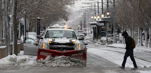
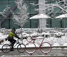
A so-called "commuter special" hammered the state at sun-up, just in time for motorists, slowing travel to a crawl and triggering dozens of slide-offs and crashes on the region's freeways and surface streets.
Big and Little Cottonwood and Parleys canyons were hit hard even before the sun rose. The Utah Department of Transportation, which reported having more than 100 snow plows out in northern Utah on Tuesday morning, quickly restricting travel to four-wheel drive vehicles or vehicles with tire chains.
The Utah Highway Patrol reported more than 70 weather-related crashes and slide-offs combined during the morning commute in Salt Lake, Davis and Utah counties on the interstates. Local law enforcement agencies reported nearly 80 more accidents on area expressways and surface streets in Salt Lake County alone.
None of the accidents involved serious injuries, including one where a semi-trailer rig lost control on snowpacked Interstate 80 just east of Echo. UHP Sgt. Todd Royce said the big rig was eastbound about 8 a.m. when it slid, hit a right barrier wall and careened into the median, where it rolled.
In another accident, at about 9:45 a.m. at 800 South and Interstate 15, a UHP trooper's car was hit — but the officer was out of the car and was not injured.
Trooper Andy Prescott was investigating a one-car crash into the left wall of the southbound lanes of the freeway when the wife of the man who had hit the wall drove up, crossed three lanes of traffic and was rear-ended by the truck. The woman's car then hit the trooper's car.
Both the drivers were transported by ambulance for treatment of minor injuries.
In eastern Utah, Dinosaur National Monument closed its quarry and exhibit center early Tuesday afternoon because of heavy snowfall.
The National Weather Service had issued a Winter Storm Warning through 4 p.m. Wednesday for the southern two-thirds of the state, predicting 8-16 inches of valley and up to 30 inches of mountain snow would fall over an area stretching from Tooele, Park City and Provo south to Nephi, Richfield, Cedar City and St. George and then east to Escalante, Moab and Monticello.
A Winter Weather Advisory was in place into late Wednesday afternoon for the northern third of the state, enfolding Logan, Brigham City, Ogden, Salt Lake City and to the west, Wendover, as well as Duchesne County in northeastern Utah. Totals ranging from 5-10 inches of snow were expected in valley locations and as much as 18 inches in the advisory area's mountain locales. The Utah Avalanche Center took note of the storms, initially putting the mountains of the entire state at "moderate" risk for potentially deadly snow slides. By Tuesday afternoon, however, the risk was elevated to "considerable."
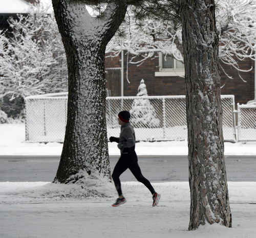
Along with snow Tuesday came a dramatic dip in temperatures. Along the Wasatch Front, the mercury — in the 50s well into Monday evening — plunged to freezing. Wednesday's highs were expected to get no warmer than the upper-teens with overnight lows a frigid 9 degrees.
Southern Utah was expected to see most of its snowfall restricted to the mountains, though forecasters warned that an inch or two could dust the valleys, along with cold rain. Highs on Wednesday were to be in the upper 30s with overnight lows in the teens, a 15-20 degree dip from Tuesday's temperatures.
For more details on the forecast, visit the Tribune's weather page at http://www.sltrib.com/weather.
Twitter: @remims
Reporter Michael McFall contributed to this story. UDOT: Be careful out there!
The Utah Department of Transportation has issued a TravelWise Alert for a winter storm expected to dump heavy road snow on Interstate 15 between Payson and Cedar City. Nearly 12 inches of snow is expected in some freeway areas, with the heaviest snowfall likely to occur between 5 p.m. Tuesday and 8 a.m. Wednesday.
Driving conditions will be difficult and UDOT advises motorists in these areas to limit travel when possible. UDOT is also working closely with the trucking industry to ensure commercial truck drivers are aware of this storm.
Heavy road snow is also expected on US Highway 40 and other routes in the Uintah Basin between Daniels Summit and the Colorado border. The snow will continue into the Basin by noon Tuesday and should end around noon Wednesday.
Travel on US Highway 6 over Soldier Summit will be difficult from 1 a.m. Tuesday until noon Wednesday.