


This is an archived article that was published on sltrib.com in 2012, and information in the article may be outdated. It is provided only for personal research purposes and may not be reprinted.
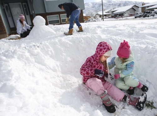
Storms will continue to visit Utah this week, but they'll be nothing to compare to the wintry weekend blast that triggered avalanches, closed canyon roads and caused hundreds of car crashes and slide-offs.
The Utah Highway Patrol reported that from Saturday through midday Sunday, Salt Lake and Utah counties combined for 31 car crashes with injuries, 106 crashes with property damage and 56 slide-offs.
In Summit County, which includes Park City and the heartbeat of the Sundance Film Festival, there were two injury accidents and 152 slide-offs, the UHP said.
Travel in Parleys Canyon was restricted to vehicles with four-wheel drive or chains on Saturday night, and Little Cottonwood Canyon was closed from 8:30 p.m. Saturday until about noon Sunday because an avalanche covered the road.
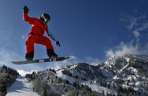
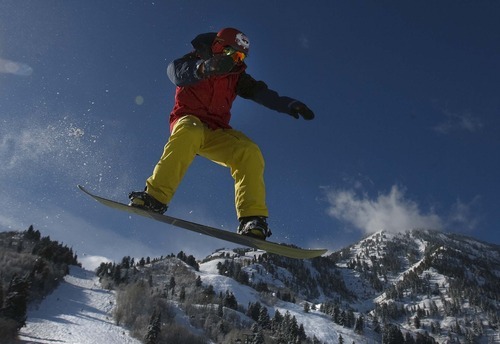
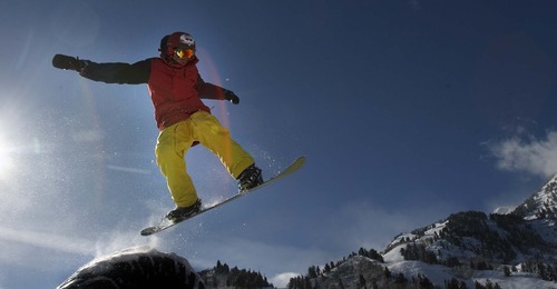
The storm dropped between 20 and 28 inches at Utah's resorts, and between 1 and 2 inches of rain in the valleys, according to Peter Wilensky, lead forecaster for the National Weather Service in Salt Lake City.
On Sunday, the snow and the closing of Little Cottonwood Canyon apparently drove hordes of skiers to the resorts in Big Cottonwood Canyon. By late morning, the parking lots were full at Solitude and Brighton resorts, forcing skiers take Utah Transit Authority buses up the canyon.
UTA spokesman Gerry Carpenter called the demand "overwhelming."
"We had every canyon bus we own out there, and it still wasn't enough to meet demand," Carpenter said in an email.
While the heavy snowfall was a boon to ski resorts, it dramatically increased the danger of backcountry recreation.
The Utah Avalanche Center on Sunday set the warning at high or extreme avalanche danger for all backcountry areas in the state. The center warned that a combination of wind and snow essentially guaranteed natural and human-caused avalanches, and that no one should be in the backcountry.
Meanwhile, the flooding that damaged homes in Weber and Cache counties on Saturday appeared to be under control by Sunday.
"The storm is over," Wilensky said Sunday.
In addition to all the precipitation, high winds were recorded in parts of the state. In the Price area, gusts hit 80 miles per hour, and areas north of Wendover saw winds of about 70 miles per hour.
The forecast shows that several weaker storms will move into the area beginning Monday evening and continuing into Tuesday. The mountains will continue to receive snow and the valleys will have a rain and snow mix, Wilensky said.
The middle part of the week should be a bit drier, but Thursday night will bring more rain to the northern valleys.
"We're still sort of getting occasional storminess, but the biggest one for this next week was the one that just passed us," Wilensky said.
— Nate Carlisle contributed to this report.
Twitter: @sheena5427 —
Big dump on resorts
In a 24-hour period concluding Sunday morning, Utah's skiers saw a phenomenal snowfall.
Alta • 22 inches
Beaver Mountain • 8 inches
Brian Head • 10 inches
Brighton • 27 inches
Canyons • 20 inches
Deer Valley • 28 inches
Eagle Point • 0 inches
Park City Mountain Resort • 20 inches
Powder Mountain • 12 inches
Snowbasin • 22 inches
Snowbird • 22 inches
Solitude • 27 inches
Sundance • 14 inches
Wolf Creek • 12 inches
Source: SkiUtah.com