


This is an archived article that was published on sltrib.com in 2011, and information in the article may be outdated. It is provided only for personal research purposes and may not be reprinted.
Remember early March, when water managers sounded the alarm that flooding seemed all but certain? The water in mountain snow threatened to replay the events of 1983, when torrents of runoff caused entire hillsides to collapse and led to widespread flooding, including a river down State Street in Salt Lake City.
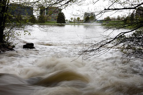
Then, on top of that enormous snowpack came the wettest 90-day period in Utah history — 11.73 inches of water was reported at the Salt Lake City International Airport and even more fell at higher elevations. Local government and water officials were apoplectic, said Tage Flint, manager of the Weber Basin Water Conservancy District that operates seven dams. "We'd wake up every morning and just shake our heads."
But the freakish winter was followed by a prolonged cold spring. That fluke, combined with the effects of flooding in 2010, meant the damage this year was spotty and contained.
"It could have been a lot worse on many fronts," said Brian McInerney, a hydrologist with the National Weather Service.
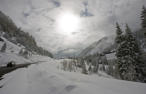
The conditions for calamity began to be develop last fall, McInerney said, when October rains saturated soils. Then winter snowfall grew to 400 percent of normal. By spring, the flooding forecast was bleak.
But cooler-than-normal temperatures slowed the snowmelt just enough to keep waterways in Salt Lake Valley from flooding. During the 75 days between April 1 and June 15, the mercury was below normal for 59 of them.
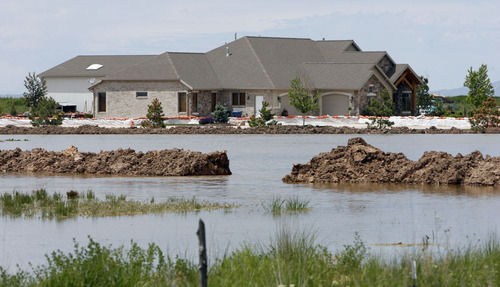
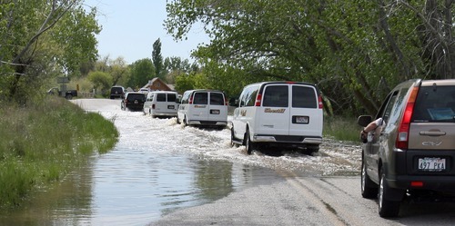
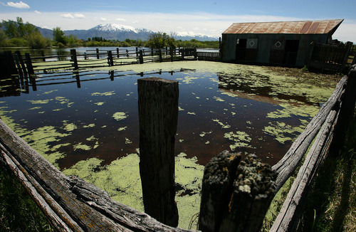
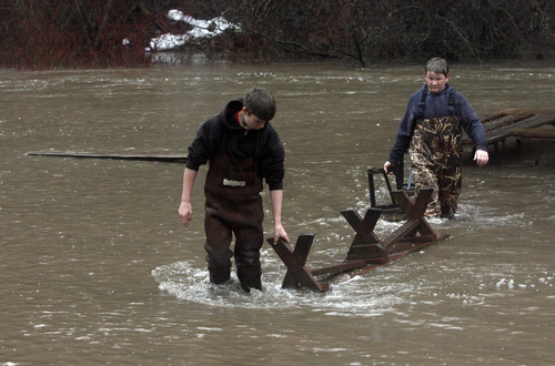
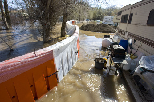
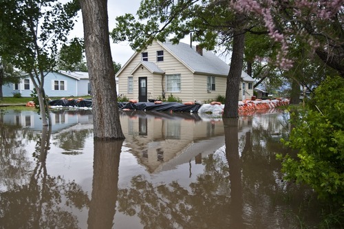
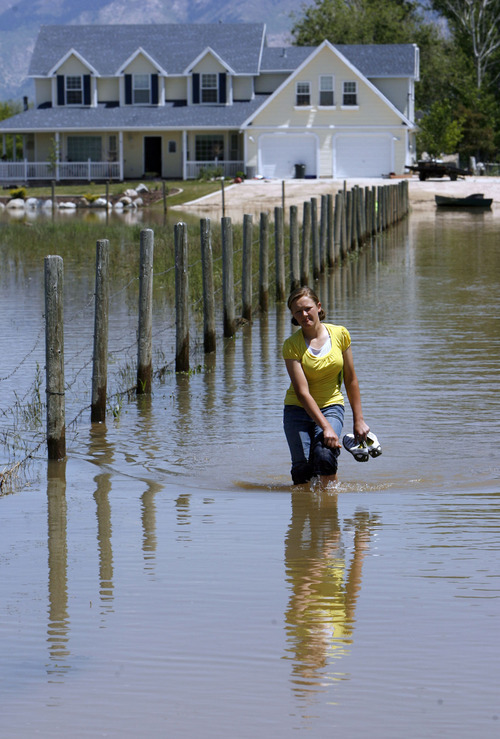
Still, the runoff was too great for the Weber River in west Weber County, where flooding of agricultural fields resulted in an estimated $90 million in losses. Spring flows this high along the lower Weber had not been seen since the 1980s.
It left farmers like Blaine Wade of West Warren in dire straits. His 300 acres were still too wet to plow by the first week of June. He was looking at a spoiled growing season and lost revenues in the hundreds of thousands of dollars. "It's been so saturated you can't grow a thing on it," he said.
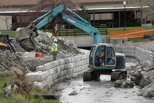
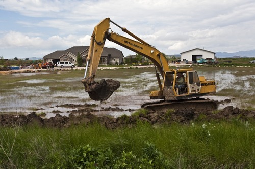
The federal Natural Resources Conservation Service (NRCS) last week announced it will provide $500,000 to Weber County and Sevier County in south central Utah to improve the channels of the Weber and Sevier rivers.
But for farmers like Wade, there is no financial aid.
Others hard-hit by the cold, wet spring include nurseries, landscapers and clothing retailers.
Part of the problem in west Weber County, according to officials, is that the river channel in the flat farmlands just east of the Great Salt Lake has filled with silt over the past quarter-century, leaving the area susceptible to big spring flows.
But the channels on the upper Weber River in Summit County and Big and Little Cottonwood creeks in Salt Lake Valley were clear, thanks in part to flooding in 2010.
"Last year was a good tune-up for this year," said Brent Beardall, engineering manager for Salt Lake County. "This year we haven't had nearly as much debris."
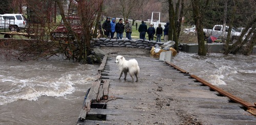
Debris is the wild card in a flood season. Tree branches and rocks can clog channels, sprouting instant dams.
Last year's flooding also prompted officials in Salt Lake Summit counties to reinforce banks on Big and Little Cottonwood creeks, as well as the upper Weber River during the past 12 months.
"Last year, we had a lot of erosion problems," Beardall said. "This year, with the help of the NRCS, we fixed a lot of those problems."
For Salt Lake City, the flood of 1983 made the big difference this year, said Jeff Niermeyer, director of public utilities.
In the wake of that deluge, Salt Lake City built a second dam in Parleys Canyon, called Little Dell. It also reinforced banks in City Creek Canyon and installed two debris basins on the channel, among other things.
"The spring runoff is usually a two- to three-week process," Niermeyer said. "This year, it stretched to 2 1/2 months and it could have easily spun out of control."
In fact, City Creek came within an eyelash of flooding, at 172 cubic feet per second. Flood stage is 180 cfs.
"There was enough water to flood," he said. "But our crews anticipated it. It was preparation and a little luck that got us through."
The upper Weber River near Oakley is still at historic high flows. It has caused some minor flooding along its banks in Summit County.
The Logan and Duchesne rivers also remain above flood stage with only minor flooding, according to officials.
But in Salt Lake County, the threat of widespread flooding is over, McInerney said. And the record snowfall is a quickly fading memory.
"When you have 400 percent of snowpack, you'd think you'd get 400 percent of peak [river] flows," he said. "But that wasn't the case."
Looking back at temperatures in April, May and the first half of June, McInerney pointed to seven peaks where the mercury rose to normal and then fell sharply. That coincided with river flows surging to flood stage and then retreating.
"Spring weather shapes the runoff," he said.
Rivers still above flood stage
While the threat of serious flooding has abated, some rivers will run high and cold from snowmelt through the Fourth of July.
Logan River • Logan
Weber River • Summit County
Duchesne River • Duchesne County
Green River • Uintah County
Source • National Weather Service