


This is an archived article that was published on sltrib.com in 2013, and information in the article may be outdated. It is provided only for personal research purposes and may not be reprinted.
Spectra Point and Ramparts Overlook
Directions • This hike is in the Cedar Breaks National Monument, located about four hours south of Salt Lake City and open from late May to mid-October. To get there, take Interstate 15 south to the State Road 143/Parowan exit. Turn left on Main Street in Parowan and left on 200 South, then take a right on 143. Follow it about 15 miles to the Visitor's Center, where you pay a $4-per-adult entry fee. Children 15 and under are free.
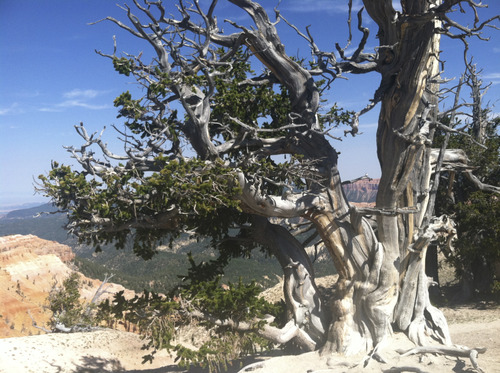
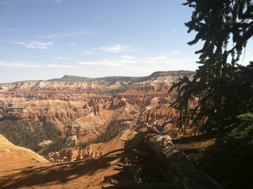
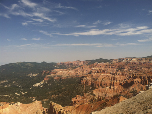
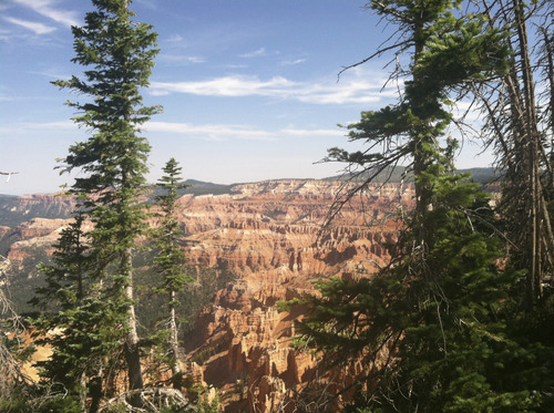
About the hike • This hike offers some of the state's best hiking features, red rock and green forest, in a neat little package. The trailhead is located on the left side of the visitor's center parking lot. It traces the rim of the beautiful red-rock amphitheater, which has plenty of spire-like hoodoo formations. Though the elevation gain isn't huge, the hike starts at over 10,000 feet, so it feels like plenty of work — make sure to bring sunscreen and water. The Spectra Point marks the halfway point of the hike. Along with the view, the point has a massive bristlecone pine tree of indeterminate age. Bristlecones are one of the world's longest-living organisms. The trail then descends down the canyon, where the terrain changes to a beautiful deep green dotted with wildflowers like Indian paintbrush, Blue columbine, Shootingstar and cinquefoil, among others. It then climbs back up for another great view of the amphitheater at Ramparts Overlook. • Trail data
Find GPS coordinates and more at: http://alltrails.com/tracks/spectra-rampart-trail Destination Spectra Point & Ramparts Overlook
Hiking time 2 hours
Round trip miles 3.35 miles
Elevation gain 721 feet
Difficulty Moderate
Trail head restrooms Yes
Dogs allowed No
Bikes allowed No