
This is an archived article that was published on sltrib.com in 2012, and information in the article may be outdated. It is provided only for personal research purposes and may not be reprinted.
Directions • From the town of Kamas, take UT-150 east for 30.2 miles. The trail head is on the south side of the road. The trail head for Fehr Lake is not marked from the road as you drive east, but there is a marker if you're driving west. If you reach the Moosehorn Lake turnoff, you've driven about 200 yards too far east.
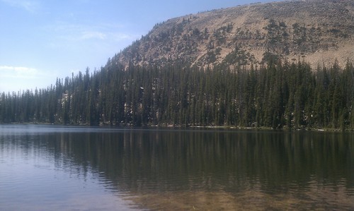
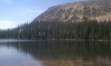
This is a well-maintained trail through meadows and forests to reach a set of mountain lakes. From the trail head, you'll step onto your first wooden pathway constructed to keep your feet out of the mud. The trail will be a mix of those wooden planks and dirt and rocks. Despite what the sign at the trail head says, Fehr Lake is .43 miles away. Stay on the trail walking around the north edge of that lake before turning southeast. At 1.31 miles is a pond some people confuse for Shepard Lake. Shepard Lake is actually downhill from the pond, 1.59 miles from the trail head. (That is not what the trail head sign tells you.) You can continue on to Hoover Lake, but it is — again — not as close as the trail head sign tells you. The ascent back to the trail head is steep until you pass Fehr Lake. Shepard Lake
Hiking time • 2 1/2 hours
Round trip miles • 3.18 miles
Elevation gain • 401 feet
Difficulty • Easy
Trail head restrooms • No
Dogs allowed • Yes
Bikes allowed • No
Fees • $6 (Mirror Lake access pass)