
This is an archived article that was published on sltrib.com in 2010, and information in the article may be outdated. It is provided only for personal research purposes and may not be reprinted.
It's wet, wild and relatively warm: A storm system born in the South Pacific and dubbed the "Pineapple Express" caused minor flooding in southern Utah on Monday and created extreme avalanche danger in the northern Utah mountains.
Meanwhile, snow covered a layer of ice on Interstate 15 near Beaver, causing several dozen cars to slide off the road and gumming up traffic flow.
The pattern will persist through Wednesday night, according to the National Weather Service.
The Utah Avalanche Center is warning people to stay out of northern Utah back-country areas where slopes are greater than 30 percent.
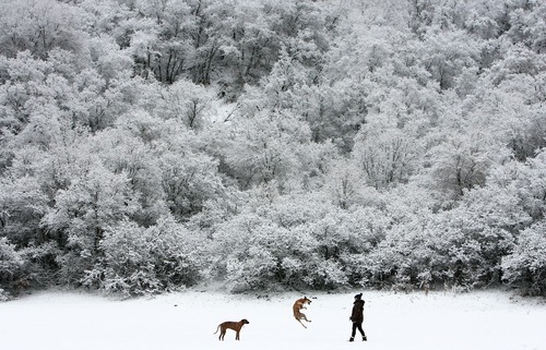
In northern Utah, heavy, wet snow clobbered higher elevations, said Brian McInerney, hydrologist for the National Weather Service.
From Saturday through 2 p.m. Monday, Solitude in Big Cottonwood Canyon had received 42 inches of snow with a water content of 4.70 inches, according to the agency.
Snowfall since Saturday at the Timp Ridge station in American Fork Canyon contained eight inches of water, McInerney said. No snow total was available.
The storm left the snowpack in mountains east of Salt Lake City at 158 percent of normal, McInerney said. And more is on the way with rain and snow expected Tuesday and Wednesday.
The heavy wet snow has set up "extreme" avalanche conditions, said Bruce Tremper, director of the Forest Service Utah Avalanche Center.
Tremper is warning skiers, snowshoers and snowmobilers to stay out of back-country areas where terrain is steep. The mountains around Provo are especially hazardous.
"We have heavy, dense snow on top of light, fluffy snow. So, it just can't hold up," he said. "It's pegged out right at the top of the [hazard] scale. It just doesn't get more extreme than this."
In southern Utah, the Virgin River is running at flood level, exceeding its banks in some areas of Washington County, including the towns of Virgin and Hurricane, according to the weather service. No serious damage to buildings has been reported.
The river should peak Tuesday around noon.
Area resident Angela Fleck pulled over Monday afternoon to take pictures of the swollen Virgin River. She remembers the floods of 2005, when a raging Santa Clara River overran its banks and destroyed a number of homes.
"This is like a flashback," she said.
A flash-flood warning through south-central Utah, including Dixie and Zion National Park, is in effect through Wednesday.
"People should avoid any dry washes, slot canyons and small streams and creeks," said Steve Rogowski, meteorologist, National Weather Service. "The main rivers will be running swift and out of their banks at certain points, so people should avoid recreational activities."
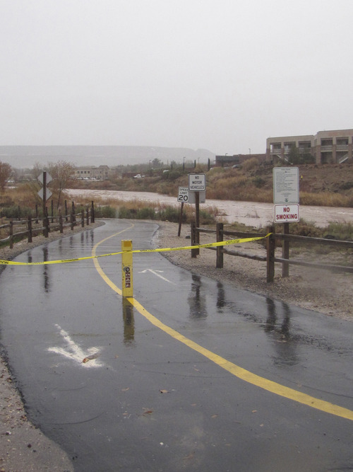
A section of the Zion-Mt. Carmel Highway within Zion National Park is temporarily closed due to a washout from the recent heavy rains, according to park officials. The affected section is about two miles west of the park's east entrance, near Crazy Quilt Mesa. The closure is expected to remain in effect for several days until road crews can stabilize the damaged piece of road.
The six-mile Zion Canyon Scenic Drive remains open. People visiting Zion Canyon via the park's south entrance at Springdale will not be in the closure area. Travelers and residents accessing Zion Canyon to or from State Road 89 will need to use an alternate route during the closure.
Washington County received between one-quarter and three-quarters of an inch of rain in the valley, and between 3 to 7 inches of snow above 8,000 feet, Rogowski said. Rain and snow will continue to fall through Wednesday.
The St. George Police Department is advising residents to avoid using the city's trail system and to stay away from the Virgin and Santa Clara rivers.
"No flooding has occurred as of yet," said St. George police Officer Johnny Heppler. "However, with more rainfall expected, we want to encourage people to be safety conscious and stay away from potentially dangerous areas."
Kevin Kitchen, a spokesman for the Utah Department of Transportation, said there were numerous slide-offs on Interstate 70 in Sevier County on Monday because of ice and snow. Northbound I-15 was closed temporarily about 15 miles north of Beaver when two semitractor trailers jackknifed due to poor road conditions about 5:30 p.m.
Conditions were "horrible" later in the evening, said Beaver County emergency dispatcher Kimbra Melvin. "Nobody should be out there. But they are."
Road damage was reported Monday afternoon in remote areas of Washington County. The Cole Spring/Manganese Springs Road crossing has been washed out and the road is closed. The Slaughter Creek Road crossing also has been closed due to high water.
U.S. 6 was closed between Skyview and the Carbon County line due to heavy snow. State Road 143 is also closed from Brian Head to Mammoth Creek. U.S. 89 was closed in both directions Monday night three miles north of Glendale in Kane County because of a landslide.
Kitchen said the road was expected to remain closed for several hours while crews work at clearing the debris. smcfarland@sltrib.comcsmart@sltrib.com
Tribune staffer Mark Havnes contributed to this report. —
Wet and warm
Here are snow/water equivalent totals (in inches) reported by the National Weather Service from Saturday morning to Monday at 2 p.m.:
Logan • 4.3/1.63
Bountiful bench • 3.2/1.71
Olympus Cove • 3.9/.0.96
Salt Lake City • 2.4/1.29
Lehi • 2.2/0.83
Heber City • 7.5/3.17