


This is an archived article that was published on sltrib.com in 2016, and information in the article may be outdated. It is provided only for personal research purposes and may not be reprinted.
The Salt Lake County surveyor's office is going airborne.
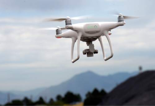
After two years of wading through Federal Aviation Administration procedures, the surveyor's office received an Unmanned Aerial Vehicle (UAV) permit last month to operate drones "to gather aerial photographs and elevation data."
"As far as we can tell from the FAA website," said Surveyor Reid Demman, "we're the only Utah agency with an active [permit]" and one of only a handful of county agencies nationwide.
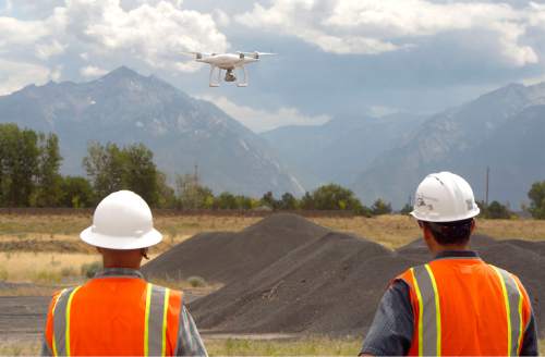
"The units will pay for themselves quickly," he said, referring to a $1,300 drone the surveyor's office has in tow and the fixed-wing drone it may add so that larger projects that require greater accuracy can be performed. The county currently is seeking bids on that drone.
"What boots on the ground took hours to do will be down to minutes," Demman said, sharply reducing the cost of surveying and mapping services. "My main goal is to reduce overhead costs."
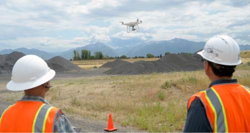
But the drones clearly have unlimited potential to be of service to many county agencies in the performance of their duties, he said.
Flood-control officials could improve views of hard-to-reach snags causing a creek to leave its banks during the spring runoff or after a cloudburst, Demman offered as one example.
Parks and Recreation officials could use drones, he added, to capture the views that hikers would see along a particular trail and post the footage on the division's website.
"Any use for county use is viable," Demman said, citing an opinion he secured from the county district attorney's office. "We could fly it inside the Salt Palace or the Capitol Theatre. It opens the door to a lot of potential uses."
To prevent misuses, the surveyor said he instituted a few internal-control rules:
• Allow no missions without Demman's approval.
• Notify property owners if a drone would fly over their lands.
• Develop a safety assessment before every mission to ensure compliance with FAA's certificate of authorization.
These rules are on top of an FAA requirement for the surveyor's office to receive agency authorization at least 24 hours — and preferably 72 hours — before a outdoor flight is to take place.
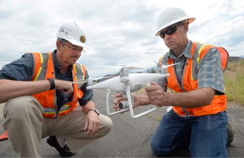
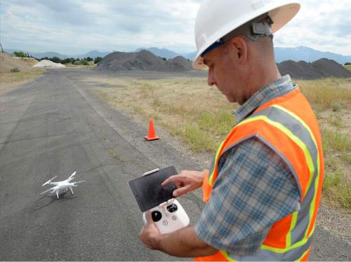
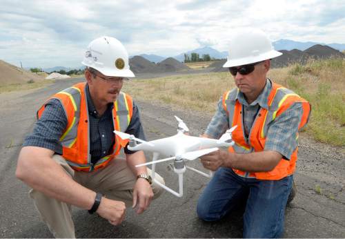
Mark Miller will be behind the drone's controls.
He heads the office's GIS and mapping services branch and went through extensive training, including a 10-week pilot ground school and a written FAA airman's test. Miller also got a Class II commercial/medical license and passed an EKG (electrocardiogram) test.
The last requirement, Miller quipped, "proved to my wife I do, indeed, have a heart."
With Miller licensed to fly, Demman invited other county agencies to propose projects, hoping to provide the FAA with credibility-building evidence of "flight hours and good usage."
"If we do something for a county agency while we're in training mode," he said, "we'll get something out of it — training and expertise — and they'll get something useful, too."
No-fly zones
Flying a drone near a wildfire is illegal in Utah, the Wildland Fire Prevention & Education Team said .
To emphasize that point, members of the Interagency Fire Center (state Department of Natural Resources, the federal Bureau of Land Management and the U.S. Forest Service) have brought in a "group of professionals" from the Pacific Northwest for a 14-day assignment to educate the public on the potential dangers of flying drones near active firefighting operations.