


This is an archived article that was published on sltrib.com in 2016, and information in the article may be outdated. It is provided only for personal research purposes and may not be reprinted.
Directions • From the town of Oakley, take State Road 32 southeast for 1 mile. Then turn east onto Boulderville Road and follow it for 2.2 miles as it curves north and becomes 1000 East. Then the road curves to the east again, becomes Pinion Lane and quickly curves north. A few hundred feet past Oakley Artesian Water, LLC, look for a gravel drive on the east side of the road. Follow the gravel drive and in one minute you will see the sign marking the trailhead for the Oakley Trail. It is at GPS coordinates 40.718729, -111.251862.
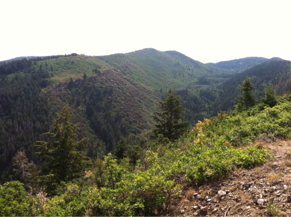
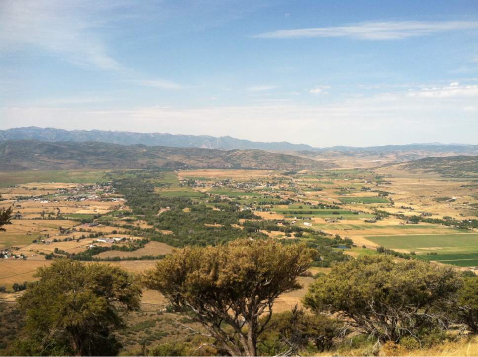
Hike • The Oakley Trail finishes atop a ridge offering a scenic view above the town of the same name, and a view of the forest to the east. From the trailhead, quickly turn left for the first of many switchbacks — 22, depending on how you count them. The South Summit Trails Foundation performed maintenance on the first half-mile of the trail in August . A walking path has been laid across a rock field covering the first few switchbacks. Then the trail becomes dirt. At 0.6 miles, you see your first views of the town. At 1.2 miles is a lookout. At 2 miles, turn left at the junction to finish the last tenth of a mile and arrive atop the ridge.
Digital map available at: http://www.trimbleoutdoors.com/ViewTrip/3271712
— Nate Carlisle
Destination: Oakley Trail ridge
Hiking time • 2 hours
Round-trip miles • 4.2 miles
Elevation gain • 1,042 feet
Difficulty • Easy
Trail head restrooms • No
Dogs allowed • Yes
Bikes allowed • Yes
Fees • No