


This is an archived article that was published on sltrib.com in 2016, and information in the article may be outdated. It is provided only for personal research purposes and may not be reprinted.
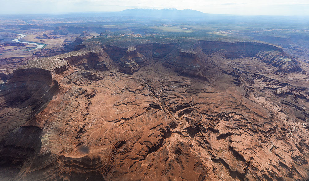
Before an inter-tribal coalition attached the name Bears Ears to what has become the most debated national monument proposal in a generation, not many used that name for the archaeological sandstone wonderland bounded by the San Juan and Colorado rivers west of Blanding.
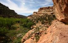
Bearing equally evocative names like Comb Ridge, Valley of the Gods, Grand Gulch, Natural Bridges, Moki Canyon and House on Fire, these places form a constellation of "attractions" that make these lands, for better or worse, a national treasure — and earned them protection as the Bears Ears National Monument.
—
Cedar Mesa
A sandstone uplift cut by countless sinuous canyons, Cedar Mesa contains the nation's most dense concentrations of artifacts and ancient cultural sites.
—
Hole-in-the-Rock Trail
Blazed by Mormon pioneers during the eponymous expedition of 1879-80, the Hole-in-the-Rock Trail crosses the mesa that is framed by Grand Gulch, Cottonwood Wash and the San Juan River.
—
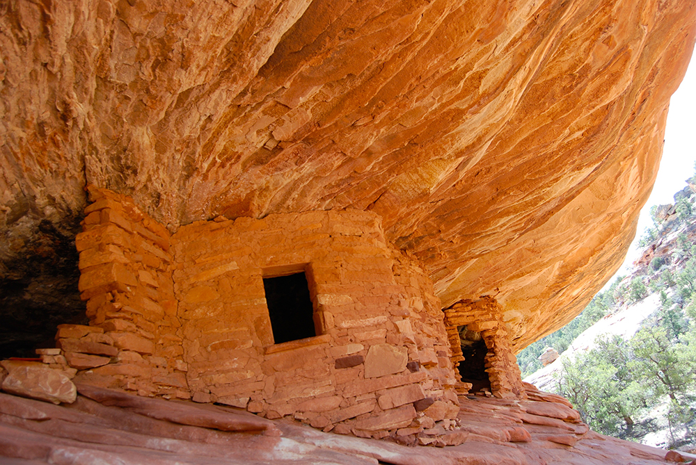
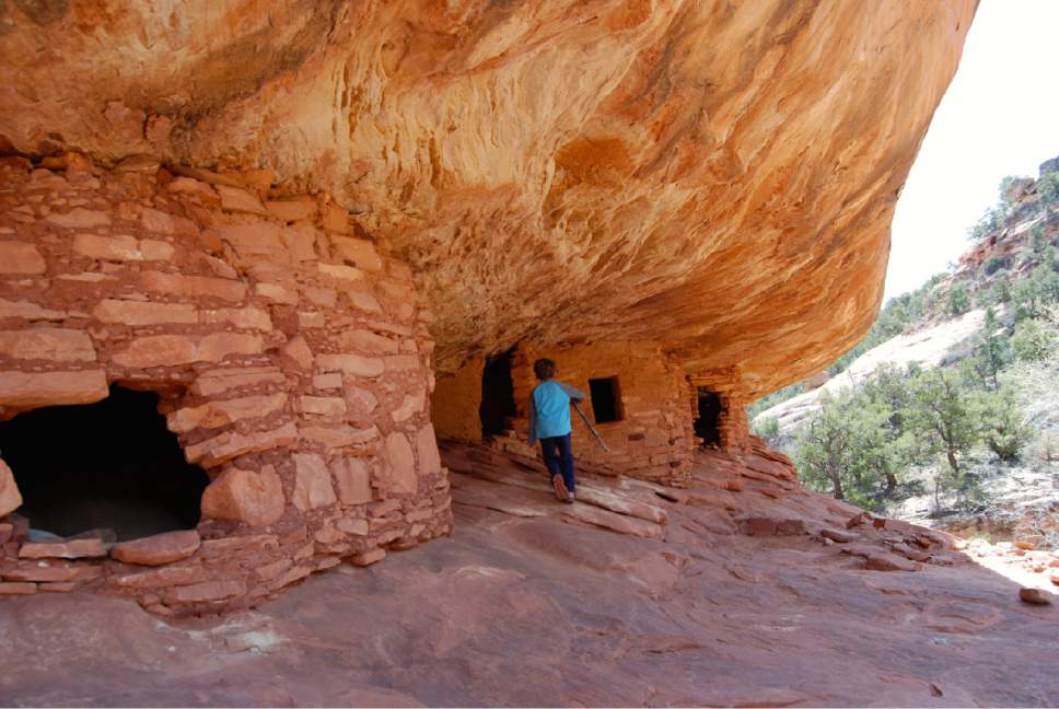
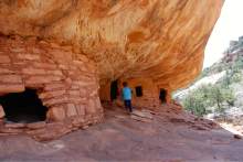
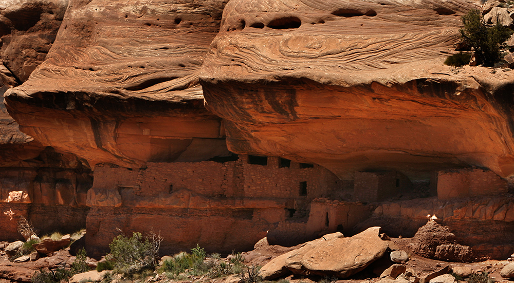
House on Fire
One of Cedar Mesa's most accessible ruins, the aptly named House on Fire is a well-preserved Anasazi dwelling a short hike up Mule Canyon. The color variations on the rounded orange cliff face suggest flames and smoke billowing from ancient masonry.
—
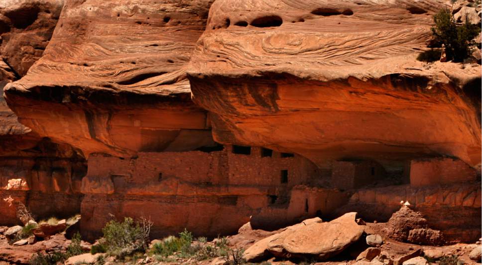
Moon House
Moon House is the mesa's most captivating and well-preserved structure, dating to the 13th century, built near the end of the Anasazi occupation of Cedar Mesa.
—

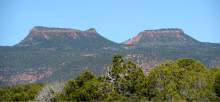
Bears Ears Buttes
Twin mesas rising 9,000 feet above sea level on Elk Ridge in the Manti La Sal National Forest, the Bears Ears Buttes are visible for miles in every direction and are held sacred by several indigenous communities.
—
Comb Ridge
Native Americans have long called Comb Ridge, the sandstone escarpment running some 80 miles south of the Bears Ears, Mother Earth's Backbone.
—

Dark Canyon Wilderness
This 46,353-acre Dark Canyon Wilderness spills off Elk Ridge and covers Dark and Woodenshoe canyons' upper drainages, which cut through layers of sandstone and limestone. Its steep narrow walls block daylight in the morning and afternoon.
—
Fish and Owl Canyon
Fish and Owl creeks incise 500-foot-deep canyons draining the east side of Cedar Mesa. They are too narrow to support much human habitation, so they don't hold many cultural sites, but they are rich in geological features, such as Nevill's Arch in Owl Creek Canyon.
—
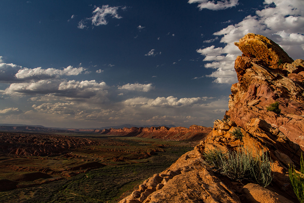
Valley of the Gods
Wind and waters sculpted a thick layer of Cedar Mesa sandstone into a massive hallway of multicolored formations with names like Lady in the Bathtub, Castle Butte, Battleship Rock and Setting Hen Butte. State Route 242 offers a tour among these remarkable features.
—
Indian Creek
The canyon, trailing along State Route 211 into Canyonlands National Park's Needles District, draws climbers to its hundreds of world-class crack-climbing routes.
—
Lockhart Basin
Popular with motorized users and climbers, Lockhart Basin rests along the Colorado River opposite Canyonlands National Park. Cliffs of Wingate sandstone hem this area.
—
Grand Gulch
Grand Gulch is a major network of canyons that drain the south slope of Cedar Mesa and join San Juan River. It is considered an "outdoor museum" because Native American artifacts and ruins dating back 1,2000 years abound here, tucked along the cliffs. Visitors should stop at the BLM's Kane Gulch Ranger Station to get permits and learn conditions before venturing into Grand Gulch and other canyons.
—

Arch Canyon
This canyon is named for three major formations: Cathedral, Angel and Keystone arches.
—
Cheesebox Canyon
Cheesebox is the largest of the many canyons off White Canyon falling off the Abajo foothills. Canyoneers explore its narrow sections, which are permanently filled with water in some place and broke up by numerous pour overs.
—
Mancos Mesa
About 200 miles of canyons wind through Mancos Mesa, an island in the sky overlooking Lake Powell. It was proposed for wilderness in the PLI.
—
Bluff Bench
This is the scenic bluff northeast of Bluff where hoodoos and ruins are within sight of proposed oil and gas wells.
—
—
Excluded from final monument boundaries
Moki Canyon
Ancient Native Americans once populated Moki Canyon, but its lower reaches are now inundated by the waters of Lake Powell. Its upper reaches remain a popular destination for hikers.
—
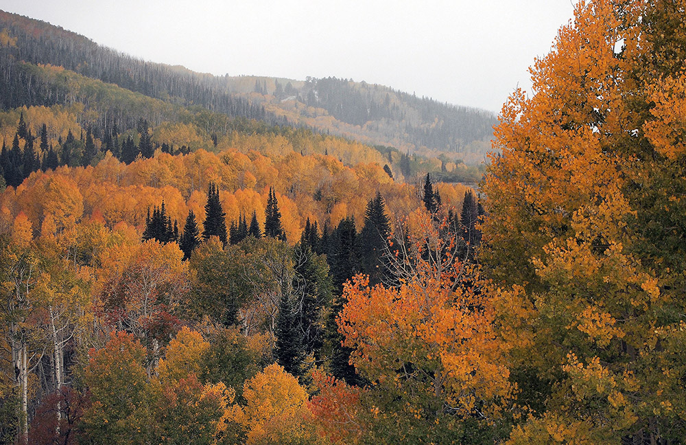
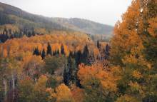
The Abajo Mountains
The Abajos rise above Monticello to an elevation of more than 11,000 feet.