


This is an archived article that was published on sltrib.com in 2016, and information in the article may be outdated. It is provided only for personal research purposes and may not be reprinted.
Wyoming wind may soon be helping power the Wasatch Front and the bright neon of Las Vegas through transmission projects whose routes were identified Tuesday by the Bureau of Land Management after years of study.
Progress on the proposed TransWest Express and Energy Gateway South power lines pleased conservationists since they would promote development of the West's renewable energy resources, but their enthusiasm cooled when they saw the final maps showing lines cutting across lands with wilderness characteristics in northwest Colorado and the Uinta Basin.
"Readily available alternative routes could have minimized or eliminated these impacts by following highways and designated utility corridors," said Alex Daue of The Wilderness Society. "The BLM has made tremendous progress in advancing a 'smart-from-the-start' approach to siting wind and solar projects, but the same cannot yet be said for transmission lines."
The group, however, sees a "silver lining" in the BLM's call for "compensatory mitigation" to offset the projects' impacts to habitat and wilderness-quality lands.
Both power lines would move wind power generated in southcentral Wyoming through northwest Colorado and across Utah. PacifiCorp is developing the 416-mile Gateway South to deliver power to the new Clover substation at Mona, about 77 miles south of Salt Lake City, while the 728-mile TransWest continues on to Las Vegas.
TransWest mostly follows U.S. Highway 40. After it enters Utah, the Gateway South right of way turns south through Bonanza and heads across upper Desolation Canyon area, chopping up a 7,100-acre area managed for its wilderness characteristics.
Conservationists are perplexed that the two lines aren't co-located through Utah, a move that would confine the impacts to a single corridor and avoid the Desolation area.
Federal officials, however, celebrated the transmission decisions, which came after comprehensive reviews exploring various alignments. The Interior Department released the records of decision, signed Tuesday by Janice M. Schneider — lands and minerals management assistant secretary — in a joint announcement that included a memorandum of understanding with California Gov. Jerry Brown. State and federal agencies are to work together on "expanded and streamlined efforts" to push renewable energy projects in California.
"These efforts strengthen our commitment to work with state and local communities to unlock the West's abundant renewable energy resources, create jobs and support development that makes sense for both the economy and the environment," Interior Secretary Sally Jewell said in a prepared statement. "Together, these initiatives will generate thousands of construction and operations jobs, cut carbon emissions by millions of tons, and help Western states meet their renewable energy goals."
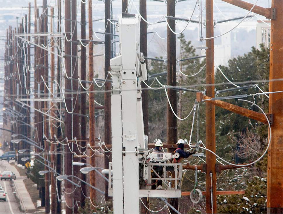
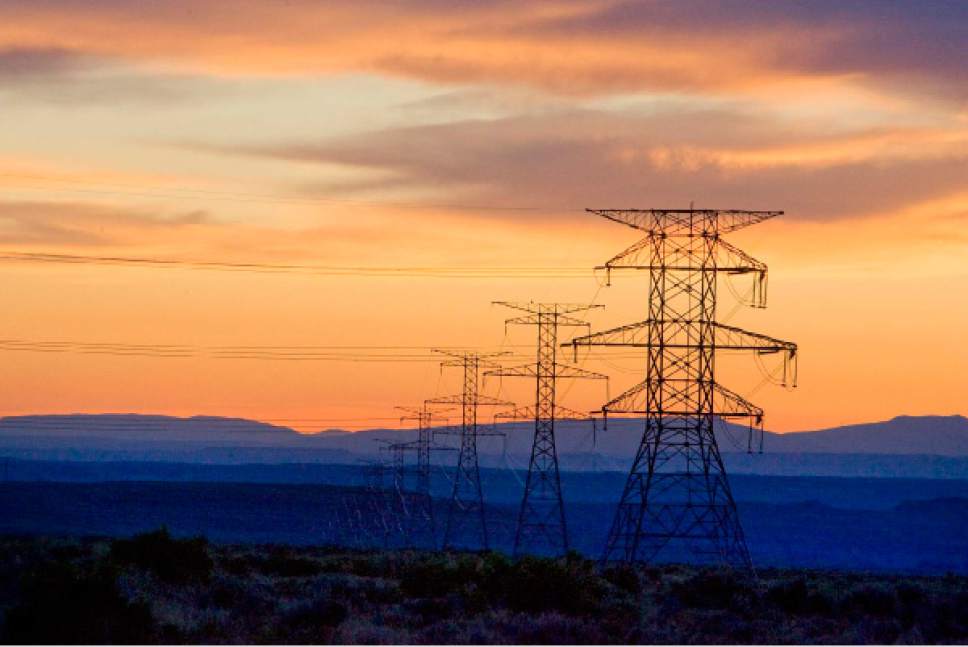
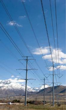
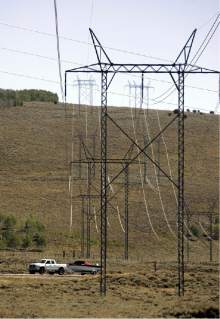
The rights of way are 250 feet wide and feature four or five support towers per mile, each 140 to 190 feet high. The $3 billion TransWest project will use a 600-kilowatt direct-current line with a 3,000-megawatt capacity or enough juice for 1.8 million homes. Gateway South will carry its load in a 500-kW alternating current line that could off-ramp some of its power en route to its destination near Mona.
TransWest's Northern Terminal, which will include a $1 billion converter station, will be sited near Rawlins, where a sister company has proposed the 1,000-turbine Chokecherrry and Sierra Madre Wind Energy Project. Gateway's northern terminal will be the Aeolus substation, 54 miles to the east near Medicine Bow, Wyo. The lines' routes share a corridor for the first 200 miles, but then track apart after crossing into Utah.
In northwest Colorado, the lines cross public lands with wilderness characteristics in Colorado's Moffat County, rather than taking a more easterly path around Craig. After entering Utah, the rights of way diverge about 10 miles west of Dinosaur; Gateway tracks south and TransWest follows U.S. 40 for the most part. About 120 miles to the west, the lines again share a common corridor, joining near Soldier Summit. At Nephi, Gateway South bends north for the short run to Mona, while Tranwest heads southwest toward Delta, where the developers envision building a substation near the Intermountain Power Plant.
State and rural county officials are generally fans of energy projects, but the lines' siting rankled some in the Beehive State. Duchesne County, for example, protested Transwest's potential for crossing private land, which is in short supply in the Uinta Basin.
State public lands officials were troubled by another aspect of TransWest's alignment through Duchesne and Wastach counties. The right of way crosses an area near Strawberry Reservoir that Utah's sage-grouse conservation plan has designated as a habitat managed to protect the imperiled ground-nesting bird. The conservation plan limits the amount of disturbance in these energy-rich lands.
Utah's public lands policy office wrote in the state's official comments that, absent off-site mitigation, the power line would prevent other projects here from being developed.
Brian Maffly covers public lands for The Salt Lake Tribune. Brian Maffly can be reached at bmaffly@sltrib.com or 801-257-8713. Twitter: @brianmaffly