

This is an archived article that was published on sltrib.com in 2016, and information in the article may be outdated. It is provided only for personal research purposes and may not be reprinted.
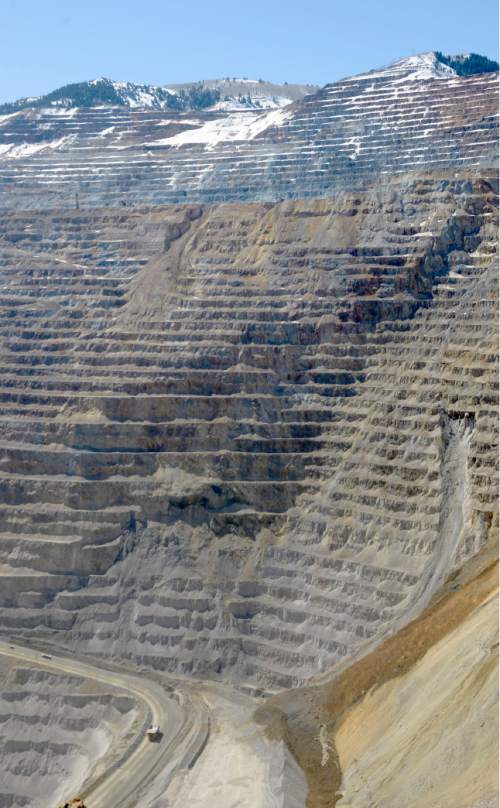
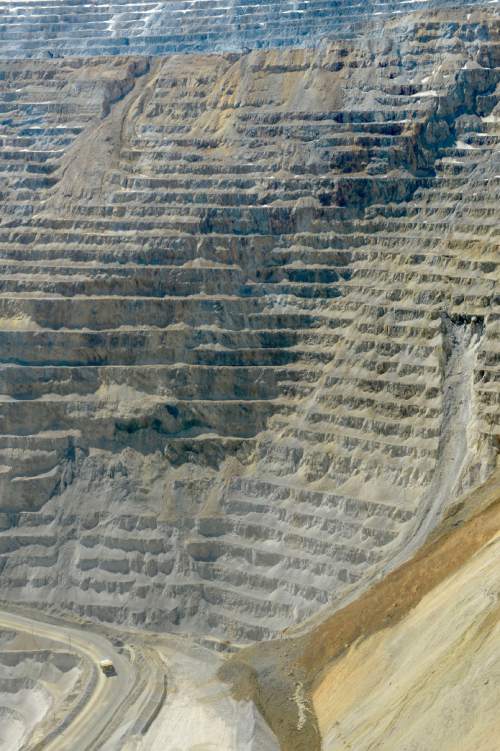
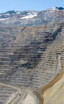
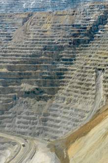
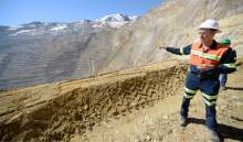
Bingham Canyon Mine • Some of this massive mine's steeply pitching, yellow-rock terraces have shown signs of potential movement lately, even releasing a few small slides.
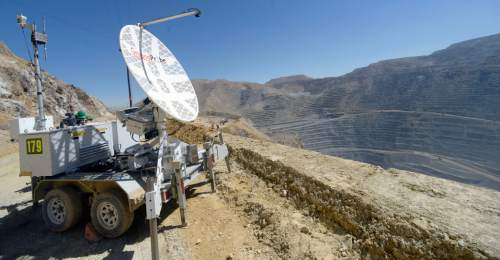
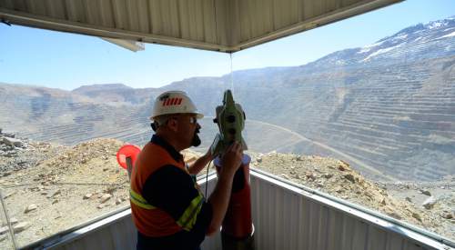
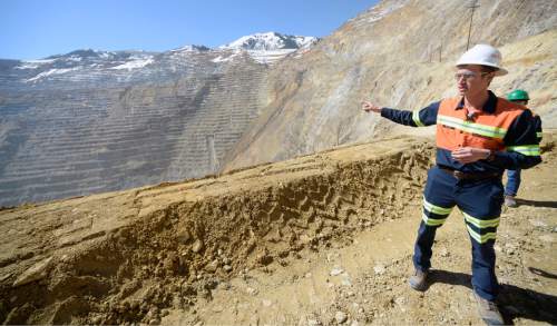
So Rio Tinto Kennecott took reporters Thursday to a point high on the western wall of the open pit copper mine to see examples of the array of high-tech gizmos employed to provide early detection of ground movement so small it's not detectable by the human eye.
"It's all about trying to keep our guys safe," said Joan Danninger, manager of Kennecott's mine technical services, referring to the 800 people who work there.
The esoteric names of the instruments she oversees seem well matched to meeting the challenge of evaluating slope stability within an ever-expanding pit so large it can be seen from space.
There are four robotic theodolites that use hourly radar sweeps to detect movement around hundreds of prisms set up strategically around the mine.
And an IBIS radar system, with four scanners that can be moved in trailers to locations where they can observe a whole wall of the pit in minutes, tracking movement down to one-tenth of an inch, Danninger said.
"If we [detect] activity, we put in ground probes," added mine operations manager Dave Meador, noting two were installed recently near a diamond-shaped section of slope that presents the greatest slide concern because it's above a heavily used haulage road.
Supplementing these devices are a "Time Domain Reflectometry" cable system that monitors subsurface movement and a dozen extensometers that provide readings every 10 minutes on ground tensions that can widen cracks. There are GPS readings, too, and on Thursday, Kennecott brought in drones for air support.
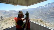
While reporters watched from a distance, a team from DroneFleet Aerospace Management in Los Angeles launched a drone equipped with a high-precision camera "to take a really good look at the tension cracks [in the slide area] and how big they are," Danninger said.
A second drone flight was scheduled later to place a prism within the moving zone where people can't go.
"Other measuring instruments will get data from it," she said, noting information is transmitted instantaneously or at regular intervals to computers where it can be analyzed by her team of geotechnical engineers, one of whom is on call around the clock.
Kennecott spokesman Kyle Bennett emphasized repeatedly that the slope movement currently under scrutiny is completely different than an April 10, 2013, "rock avalanche" that deposited 165 million tons of dirt in the bottom of the pit.
That event, which moved rock downhill at speeds of up to 100 mph, triggered 16 earthquakes and was deemed by scientists to be the largest, nonvolcanic landslide in North American history. It slowed mining operations for a year and triggered a round of layoffs and early retirements to cut costs.
What's happening now on the opposite side of the pit, Bennett said, is a threat more seasonal in nature.
It's driven by melting snow percolating into the pit's flanks from the higher ridges of the Oquirrh Mountains, flowing along cracks often created by the daily freezing/thawing cycle of spring.
The slides being triggered are tiny by comparison to the 2013 event, Bennett said.
While they may cause mine officials to evacuate part of the mine for brief periods, he added, the movement is causing "no interruption to business, no impacts to people."