


This is an archived article that was published on sltrib.com in 2014, and information in the article may be outdated. It is provided only for personal research purposes and may not be reprinted.
At least one Utah radio station is already playing Christmas music, and to its credit, it's beginning to look like that time in some parts of Utah.
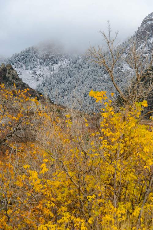
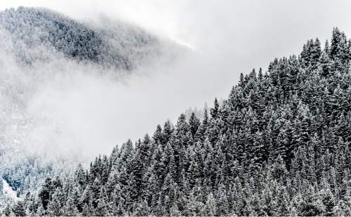
After dumping rain in the valleys and snow in the high elevations over the weekend, the slow-moving storm is expected to linger into Monday. Parts of the Wasatch Front are even expected to see lake-effect snow into the morning, mainly causing wet roads for valley floors, but light slush on the benches from the heavier showers, according to the National Weather Service.
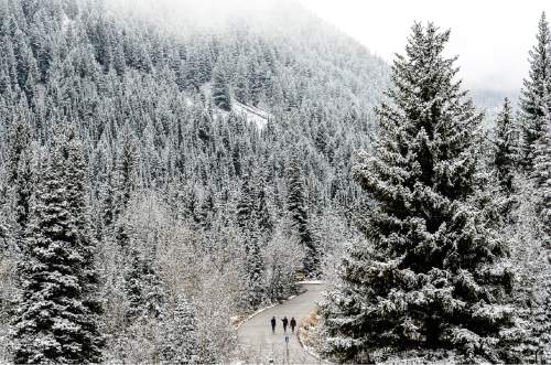
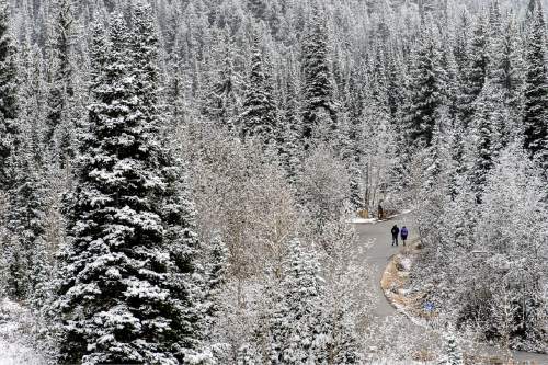
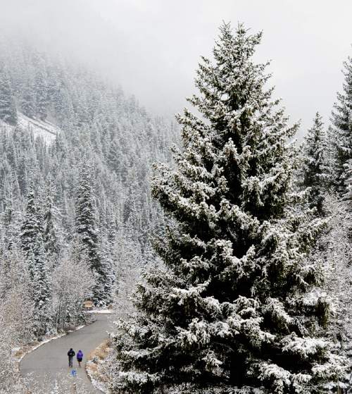
Alta Ski Resort saw 11 inches of snow as of Monday morning, 6 inches at Brighton, 2 inches in Provo Canyon and 3 inches in Cedar City, according to the National Weather Service.
Seasonal road closures also are in effect, with Guardsman Pass and the American Fork/Alpine Loop closed starting Monday, according to the Utah Department of Transportation.
High-elevation roads, such as Parley's Summit and the upper Cottonwood Canyons, could see 1 to 2 inches of slush, the weather service adds.
A dusting of snow is also possible in Salt Lake County and southern Davis County, according to the weather service.
A winter-weather advisory was in effect until 10 a.m. Monday for the Wasatch and western Uinta Mountains. Snow will continue into Monday morning, adding another 3 to 6 inches to what's already accumulated.
"Slushy accumulations are expected on higher-elevation roads," the advisory reads, "especially on seasonal high-elevation passes that have not been closed for the winter … as well as Parley's Canyon Interstate 80 for the Monday morning commute."
Chilly temperatures are still on tap for Monday, with a high of 50 for Salt Lake City, followed by a low of 36. Logan will see a similar daytime high of 47, but the projected low for Monday night plummets to 21 degrees, according to the weather service. St. George, meanwhile, will see a high temperature of 62 on Monday, followed by a low of 40.
Tuesday will see a clearing out, with a high near 53 in Salt Lake City. Southern Utah will see a high near 64 on Tuesday and sunny skies.
The storm brought a mix of rain and snow Sunday as it moved east across the state. Meteorologists did not expect any significant accumulation in the valleys, since "ground temperatures are still fairly warm," their Sunday weather advisory read.
The mountains, though, were expected to receive several inches of accumulation, mainly above 8,000 feet, according to the weather service.
As of 1 p.m. Sunday, snow had shut down Kolob Canyons Road, according to Zion National Park.
The wet weather is a decided change in tone from the mostly dry, blustery first act to this storm on Saturday. The winds ahead of the oncoming storm knocked around semi-trucks in Tooele County, forced highway closures and were the likely culprit for thousands losing power along the Wasatch Front.
Visit The Tribune's weather page at http://www.sltrib.com/weather for more extensive forecast information.
Twitter: @mikeypanda