


This is an archived article that was published on sltrib.com in 2016, and information in the article may be outdated. It is provided only for personal research purposes and may not be reprinted.
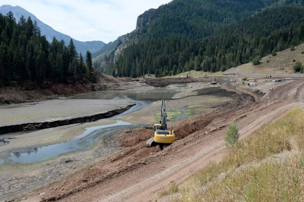
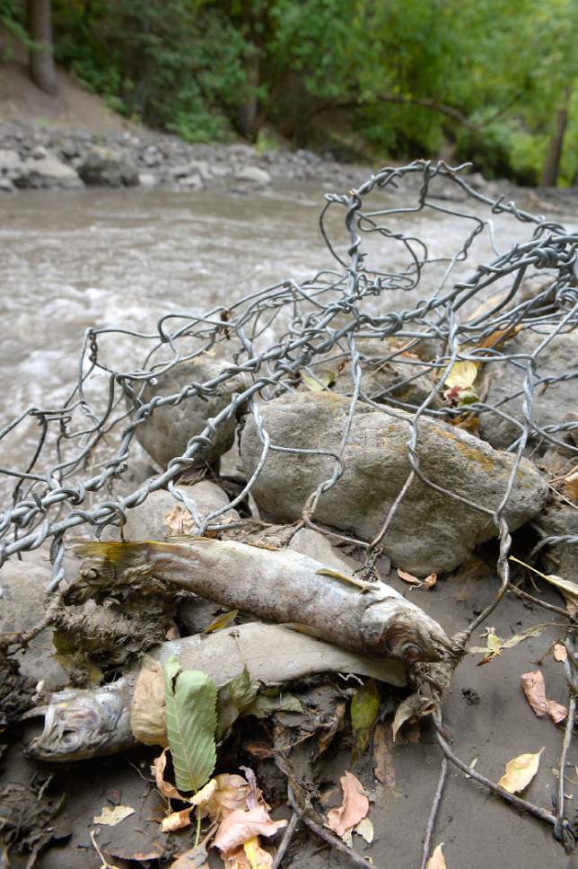
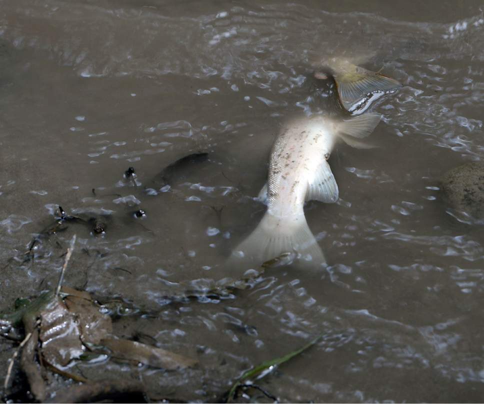
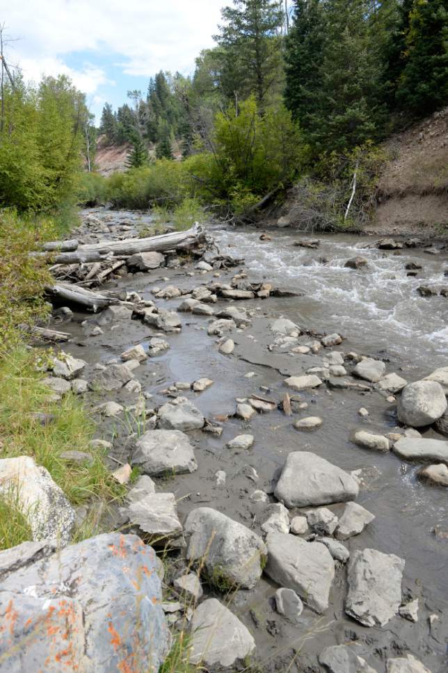
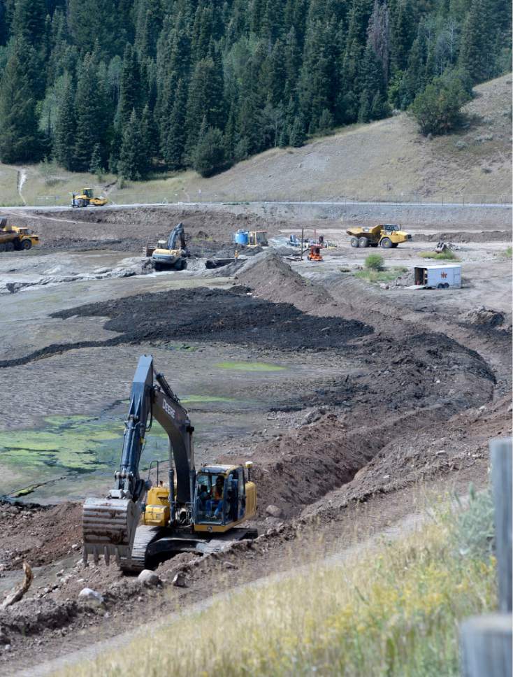
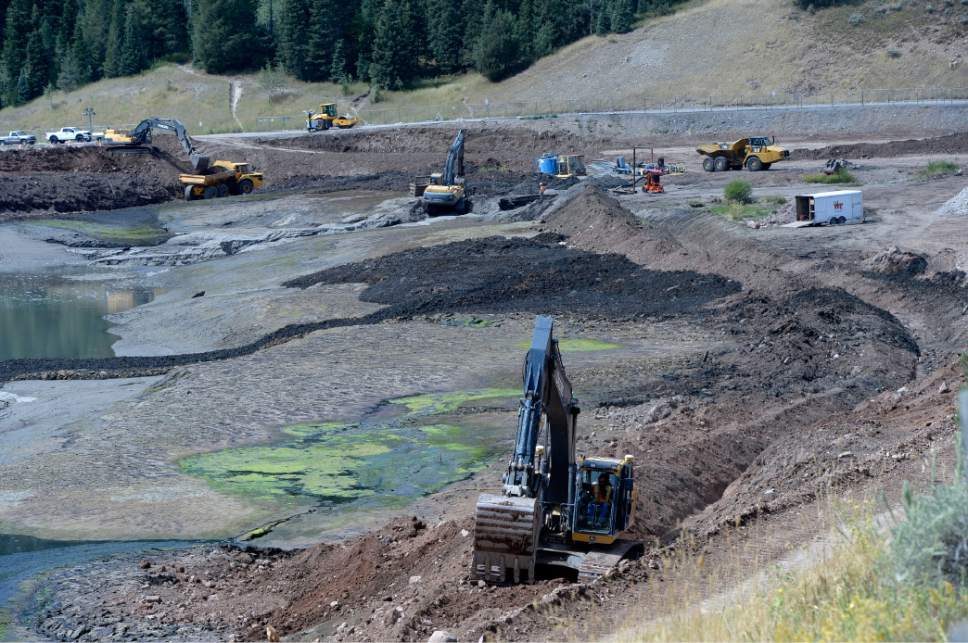
Although "best management practices" were to be used to keep Tibble Fork Reservoir's sediments out of the American Fork River, the Utah water district that is rehabilitating the dam drained the reservoir last weekend in a manner that allowed the river to incise a deep channel through 12 feet of potentially toxic muck and push the filth down one of Utah's favorite trout streams. While the water has since cleared somewhat, the sediment releases have continued virtually unabated because water officials cannot shut off releases without dewatering the river.
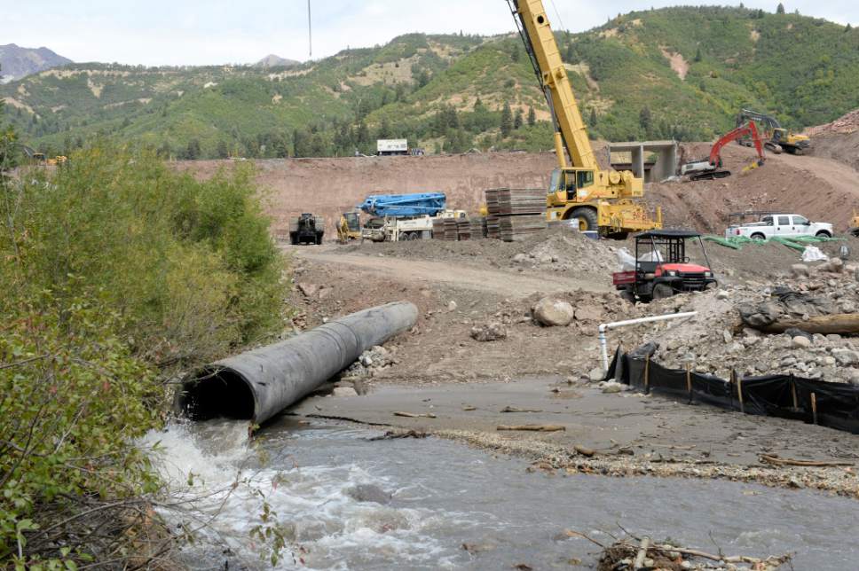
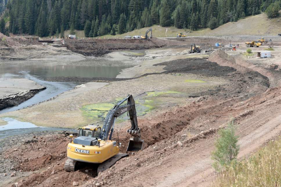
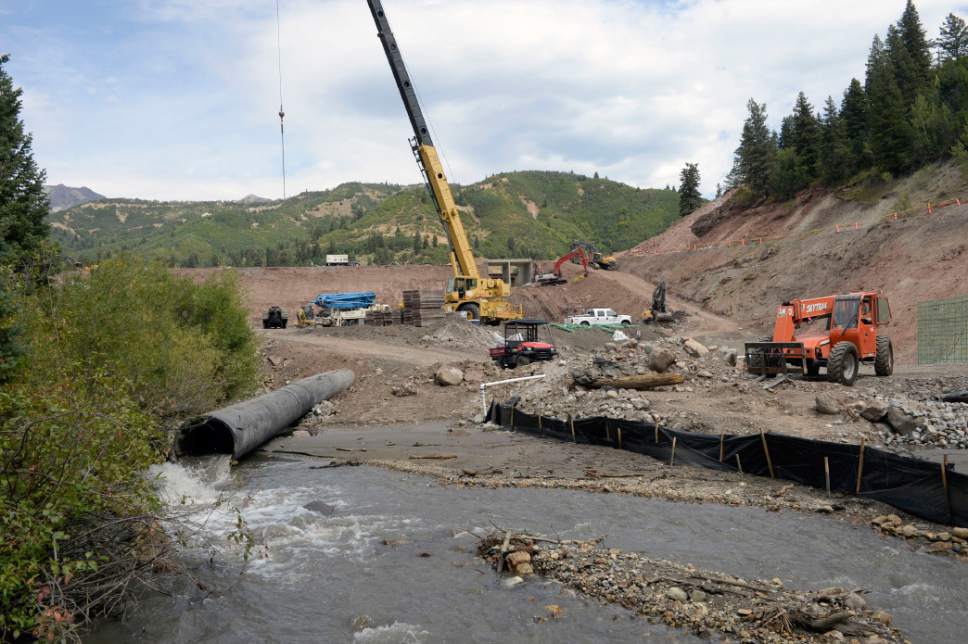
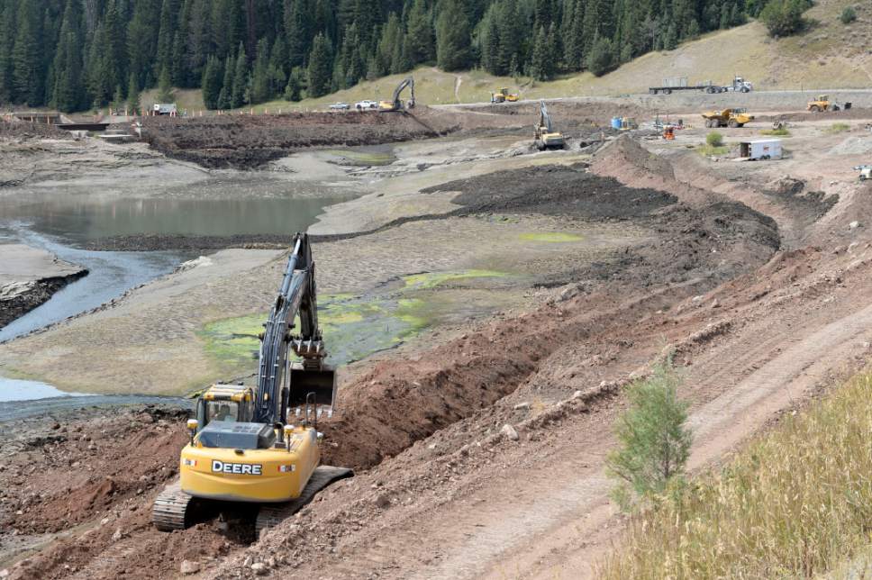
The North Utah County Water Conservancy District's contractor is now digging a channel and laying pipe to divert the river's flow around 10-acre lake bed, contaminated from a legacy of gold and silver mining in the canyon's headwaters.
"They are working around the clock to do it. We said it would be within four days, and we will beat that schedule," said Brad Price of Provo-based RB&G Engineering, which designed the dam-rehab project. The river's flow should be moving around the lake by the pipe sometime Friday, he said, putting an end to the release of pollution that has been killing fish and fouling the popular canyon outside Provo for nearly a week.
Meanwhile, test results from water samples taken Monday and Tuesday had trickled back, but officials were still analyzing them late Thursday. The Utah Division of Water Quality planned to post the results once analysis was complete. Officials also are awaiting results from sediment and fish samples.
These results are crucial for advising northern Utah County water users how to respond to the crisis. The American Fork River feeds farms and secondary water systems in Highland and surrounding communities where residents were unsure whether they should keep the water off their lawns and gardens. There was enough uncertainty Wednesday that the U.S. Forest Service advised canyon visitors to stay out of the river as a matter of "common sense."
"I chased some kids out of the river [Wednesday] on my way home from work," said Jim Ireland, superintendent of Timpanogos Cave National Monument, which covers about a mile of stream in the lower reaches of the canyon. Monument personnel took water samples Monday that came back showing elevated levels of several metals, according to Ireland.
"We are concerned," he said. "We have a mission to preserve the resources of the monument and this is obviously an impact."
As of Thursday, however, the Utah County Health Department had refrained from advising residents against using the water for irrigating their yards.
Jonny Torrence, an angler who lives in American Fork, is believed to be the first to notice the fouled water when he entered the canyon Sunday evening to take his 3-year-old daughter fishing.
He had fished the canyon three days earlier and pulled 20 brown trout from the river's clear waters. But on Sunday, something was clearly wrong.
"I walked to the river and saw that it was absolutely brown," said Torrence, who snapped photos and alerted a local Trout Unlimited chapter that night. "I walked upriver and saw dead fish everywhere. It was flowing like pudding, it was so thick. By the time I got back to the road, it had gone down 3 or 4 inches because you could see the [deposited sediment] up on the banks that you couldn't see before.
"I was shocked. That's where my dad taught me to fly fish," he continued. "I would have thought it would be managed closer and they would take extreme precautions to prevent something like this."
Officials from the water district and the federal Natural Resources Conservation Service (NRCS), which helped fund the dam project, say precautions were taken and that it was expected that the reservoir draw-down would release some sediment.
However, the environmental assessment on the project indicated that no sediments should have escaped down the river. This is because levels of toxic heavy metals, such as arsenic and lead, are so elevated in the lake bed that the material could not be used as fill on the dam, whose crest will be raised 15 feet.
"The top layer of soil containing heavy metals would be tested, and any locations that exceed screening levels would not be disturbed," states the document, which the NRCS prepared. "These contaminated soils are not expected to be transported downstream and would therefore not affect the surrounding environment. Proper use of BMPs" — best management practices — "and timing of construction would almost eliminate contaminated soils from moving downstream during earth-disturbing activities."
Critics believe the heavy sediment releases would have been avoidable had the reservoir draw-down been better managed. Water flows into the reservoir at a rate of 12 cubic feet per second (cfs) from American Fork River and another 4 cfs from a side stream called Deer Creek, just a few hundred feet upstream of the dam. The plan was to release water at 40 cfs.
The actual rate of release remains a matter of dispute. But whatever the rate, it was apparently too fast, according to Brian Wimmer, president of the Trout Unlimited chapter that has been monitoring the spill and its aftermath.
A properly controlled release would have slowed the water flowing across the sediment bed once the reservoir emptied.
Instead, fast-moving water cut a deep trough through the silt, which was carried through the dam gate and down the river.
Little is known about these deeper sediments, which were deposited 50 years ago when mining activity upstream was still fresh. Wimmer, Ireland and others are concerned these deep layers might be richer in toxic metals than sediments near the surface that had been previously tested.
"We know the river will run clear again, but they are called heavy metals for a reason," Ireland said. "They drop out of solution very quickly and end up in the sediment. That means they will stick around."
Brian Maffly covers public lands for The Salt Lake Tribune. Maffly can be reached at bmaffly@sltrib.com or 801-257-8713.
Twitter: @brianmaffly