


This is an archived article that was published on sltrib.com in 2014, and information in the article may be outdated. It is provided only for personal research purposes and may not be reprinted.
Heavy, wind-blown mountain snowfall prompted Winter Storm Warning advisories on Monday for Utah's northern and central mountains, along with elevated risks for potentially deadly avalanches.
The storm warnings predicted up to 20 inches of new snow above 7,000 feet elevation by 6 p.m. Monday, when the advisories were set to expire. The northeast Uinta Mountains were under a Blizzard Warning through midnight, and a Wind Advisory (gusts approaching 60 mph were predicted) was in place for the Great Salt Lake Desert and mountains of northwest Utah through 8 p.m. Monday.
Snow slowed the commute through Big Cottonwood Canyon, where four-wheel drive vehicles or tire chains were required as Monday dawned. Little Cottonwood Canyon was closed until 8:30 a.m. to allow Utah Department of Transportation crews to undertake avalanche control work.
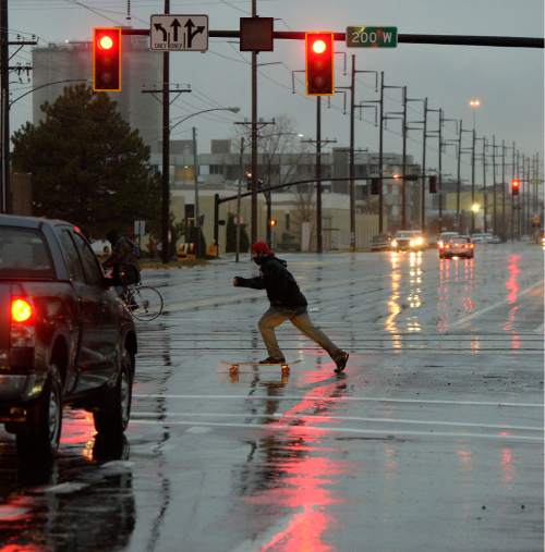
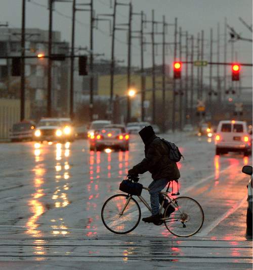
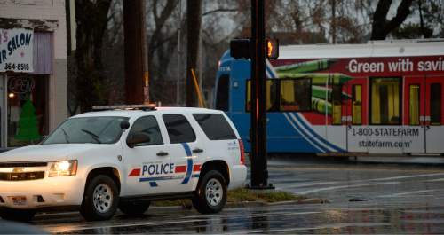
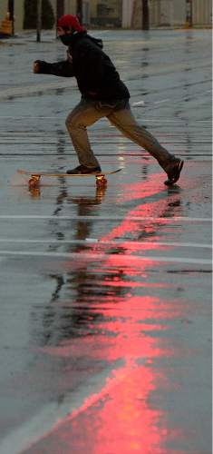
Temperatures in the 40s, however, kept the precipitation mostly in the form of rain along the valleys of the Wasatch Front. Occasional snowflakes were possible, but no valley accumulations of the white stuff were expected on Monday.
Tuesday's forecast for the Salt Lake and Tooele valleys is chillier, with daytime highs in the upper-30s and overnight lows in the low- to mid-20s.
Southern Utahns expected a windy, sunny Tuesday with highs in the low- to mid-50s, a few degrees cooler than Monday's forecast, which also called for stiff breezes in the 20 mph range.
Bountiful and dense snowfall in the mountains translated to "red," or high risk for avalanches on Monday, according to the Utah Avalanche Center. That danger applied to the mountains of Logan, Ogden, Salt Lake City, Provo and the Uintas and Skyline districts.
For more extensive forecast information, visit the Tribune's weather page at: http://www.sltrib.com/weather.
Twitter: @remims For Northern Utah:
A persistent storm system will continue to impact portions of northern Utah through Monday night. Periods of road snow/slush will continue to impact northern mountain routes through Monday afternoon under heavier snow showers before precipitation ends in the evening. The threat for lingering road snow and patchy ice will continue into early Tuesday. Rain showers will remain a threat through the Cache Valley and Wasatch Front, with periods of wet roads through Monday afternoon. The following routes will continue to experience periods of road slush/snow during the forecast period:
— I-80, near Parleys Summit and Wahsatch Hill
— I-84, from the Idaho border through Chaulk Hill
— US-89, Sardine Summit and east of Logan through Logan Summit
— Little and Big Cottonwood Canyons (SR-210 & SR-190), especially near the resorts
— US-40, through Daniels Summit & Strawberry Reservoir (south of Heber City)
— US-191, through Indian Canyon Summit (between Duchesne and Helper)
— US-191, north of Vernal to the Wyoming border
— US-6, from Spanish Fork east over Soldier Summit, to Price
— SR-158, over Powder Mountain
— SR-150, from Kamas through Bald Mountain Pass
— SR-39, from Trapper's Loop to Monte Cristo
For Central/Southern Utah:
A persistent storm system will continue to impact portions of central and southern Utah through Monday night. Periods of mountain road snow/slush will continue into Monday evening before precipitation tapers off Monday night. The threat for areas of road snow and patchy ice will linger into early Tuesday. Precipitation is expected to remain as rain through Utah Valley and the Southern Wasatch Front during the day Monday, keeping lower valley roads wet. Higher elevation areas along I-15 and US-89 will have a threat for brief slush early Monday morning and again early Sunday morning. The following routes will experience periods of road slush/snow during the forecast period:
— I-70, over Clear Creek Summit; and from Salina to Fremont Junction (over Ivie Creek Summit)
— I-15, Scipio Summit, Pine Hill, Beaver Ridge, and Cove Fort/I-70 Junction
— US-89, from Thistle south to Mt. Pleasant, and between Circleville and Glendale
— US-191, near Monticello
— SR-31, between Fairview and Huntington
— SR-96, from Scofield to Colton
— SR-264, from top of Fairview Canyon to SR-96 Junction
— SR-153, over 153 Summit
— SR-143 & SR-14, near Brian Head and Cedar Breaks National Monument
— SR-20, top of Bear Valley
— SR-12, higher elevations, including Boulder Summit
— SR-24, between Richfield and Loa, through Wayne Summit
— Utah Department of Transportation