


This is an archived article that was published on sltrib.com in 2015, and information in the article may be outdated. It is provided only for personal research purposes and may not be reprinted.
Directions • The trailhead is next to the electrical substation in the parking lot of the Jewish Community Center, 2 N. Medical Drive in Salt Lake City. There are few public parking spots, but you can take the bus. Utah Transit Authority multiple routes that arrive across the street at University Hospital or what the transit authority refers to as "Medical Center." Go through the hikers' gate in the chain link fence on the substation's north side.
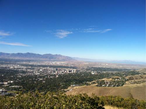
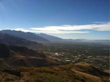
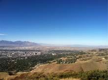
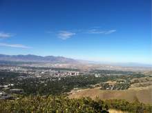
Mount Van Cott offers great views of the campus, the city and the valley in relatively short order. From the trailhead, go through the gate and follow the road north. In a few hundred yards, you'll start to see a lot of trails offering some way to reach Mount Van Cott. The most direct route is take the trail going northeast with a steep ascent up the mountain. There's one short switchback and then the trail ascends again. At about sixth-tenths of a mile, the trail levels and travels southeast around the middle of the mountain. The trail turns northeast and begins ascending again. At about the 1-mile mark, you turn north and will follow the trail to the rocky ledge that is the top of Mounta Van Cott. DestinationPeak
Hiking time2 hours
Round-trip miles3.4
Elevation gain1,365 feet
Difficultymoderate
Trailhead restroomsNo
Dogs allowedYes
Bikes allowedYes
FeesNo