

This is an archived article that was published on sltrib.com in 2014, and information in the article may be outdated. It is provided only for personal research purposes and may not be reprinted.
Directions • From Interstate 15, exit onto University Parkway in Provo and drive east for 4.5 miles. Then turn south onto 900 East. After half a mile, turn east onto Birch Lane. Take a quick left onto Apple Avenue then a very quick left onto Old Willow Lane. Turn right onto Oakmont Lane then left onto Oak Cliff Drive. Turn right onto Terrace Drive and you'll see signs for the Y Mountain trail head on your left. Or if you want to travel by GPS, go to coordinates 40.24507, -111.62738
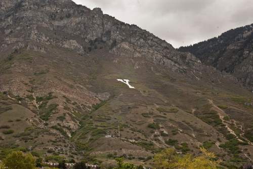
You don't need to be a Brigham Young University student or fan to enjoy Y Mountain. It has become one of Utah's iconic hikes. What the trail lacks in distance, it compensates for in quick elevation gain. The trail is well marked and consists of a series of series of switchbacks. Most switchbacks have benches where you can rest and enjoy the view. The best view is from the top or bottom of the huge white Y. You'll be able to see the BYU campus, Provo, and Utah Valley. Destination The Y
Hiking time 1 hours
Round trip miles 2.4 miles
Elevation gain About 1,000 feet
Difficulty Easy
Trail head restrooms Yes
Dogs allowed Yes/No
Bikes allowed No