Nate Carlisle | The Salt Lake Tribune
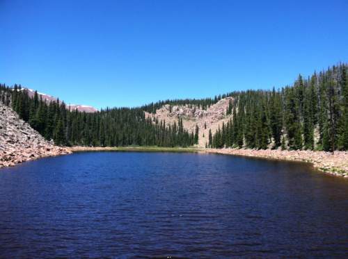
Deer Lake, seen here on July 11, 2016, sits on the south slope of the Uinta Mountains in th
Nate Carlisle | The Salt Lake Tribune
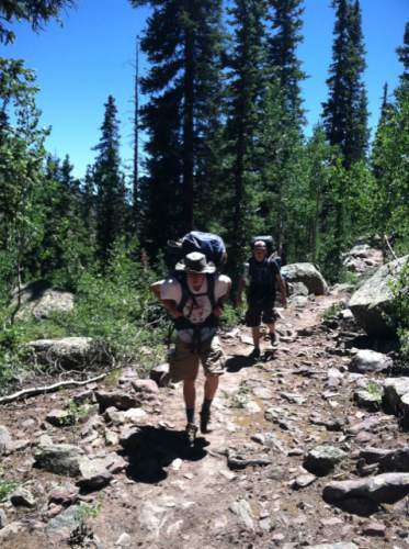
Two hikers from the Clinton LDS Second Ward hike the trail to Deer Lake in the Uinta Moun
Nate Carlisle | The Salt Lake Tribune
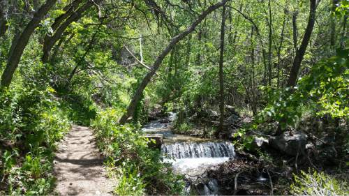
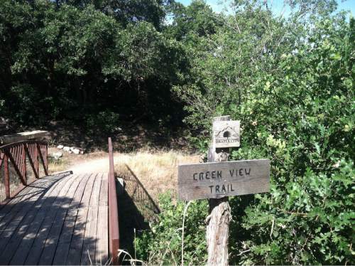
The Creek View Trail in Draper, seen here on June 28, 2016, offers a walk through wooded
Jessica Miller | The Salt Lake Tribune
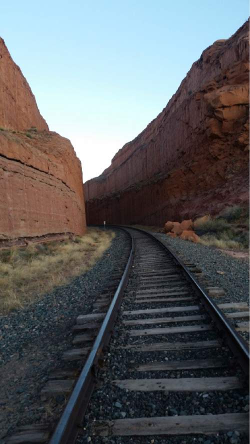
Strong's Canyon trail in Ogden.
Nate Carlisle | The Salt Lake Tribune
The Creek View Trail, seen here on June 28, 2016, in Draper is part of the Corner Canyon
Jessica Miller | The Salt Lake Tribune
Strong's Canyon trail in Ogden.
Erin Alberty | The Salt Lake Tribune
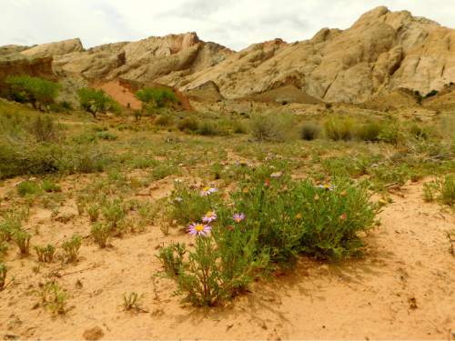
Wildflowers greet hikers near the wash to the Moonshine Tanks on May 1, 2016, in the San R
Erin Alberty | The Salt Lake Tribune
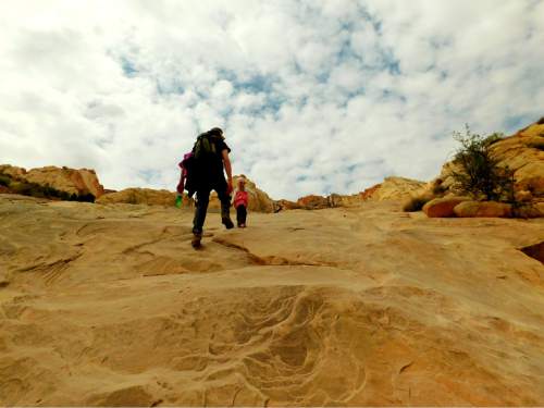
Father and daughter march up a slickrock slope May 1, 2016, near Moonshine Tanks in the Sa
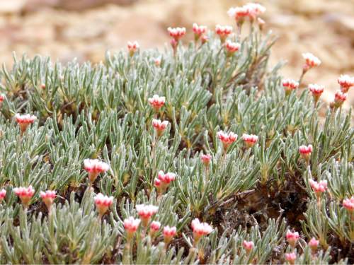
Erin Alberty | The Salt Lake Tribune
Eriogonum buds prepare to burst into poms May 1, 2016, near Moonshine Tanks in the San Raf
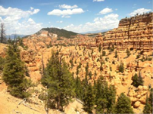
Nate Carlisle | The Salt Lake Tribune
The Golden Wall Trail in southern Utah's Red Canyon offers hoodoos and vistas.
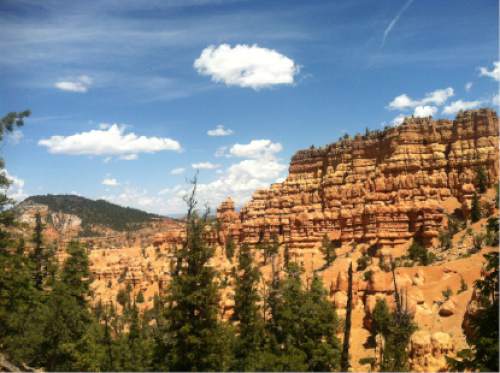
Nate Carlisle | The Salt Lake Tribune
The Golden Wall Trail in southern Utah's Red Canyon offers hoodoos and vistas.
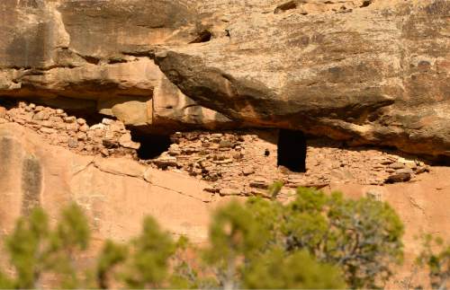
Leah Hogsten | The Salt Lake Tribune
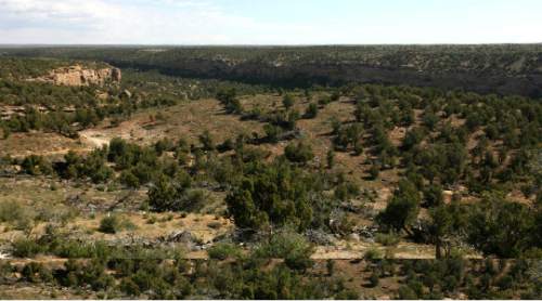
Pueblo III-period cliff dwellings created by the Anasazi or Ancestral Puebloan peoples bet
Leah Hogsten | The Salt Lake Tribune
Pueblo III-period cliff dwellings created by the Anasazi or Ancestral Puebloan peoples bet
Jessica Miller | The Salt Lake Tribune
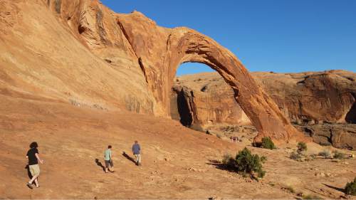
Corona Arch trail in Moab, Utah.
Jessica Miller | The Salt Lake Tribune
Corona Arch trail in Moab, Utah.
Nate Carlisle | The Salt Lake Tribune
Deer Lake, seen here on July 11, 2016, sits on the south slope of the Uinta Mountains in the Ashley National Forest.
Nate Carlisle | The Salt Lake Tribune
Two hikers from the Clinton LDS Second Ward hike the trail to Deer Lake in the Uinta Mountains on July 11, 2016. Deer Lake is a 12-mile roundtrip where hikers gain 2,316 feet.
Nate Carlisle | The Salt Lake Tribune
The Creek View Trail in Draper, seen here on June 28, 2016, offers a walk through wooded areas and Corner Canyon.
Jessica Miller | The Salt Lake Tribune
Strong's Canyon trail in Ogden.
Nate Carlisle | The Salt Lake Tribune
The Creek View Trail, seen here on June 28, 2016, in Draper is part of the Corner Canyon trail system. The trail is 3.46 miles from the Corner Canyon Trailhead to the Coyote Hollow Trailhead.
Jessica Miller | The Salt Lake Tribune
Strong's Canyon trail in Ogden.
Erin Alberty | The Salt Lake Tribune
Wildflowers greet hikers near the wash to the Moonshine Tanks on May 1, 2016, in the San Rafael Swell.
Erin Alberty | The Salt Lake Tribune
Father and daughter march up a slickrock slope May 1, 2016, near Moonshine Tanks in the San Rafael Swell.
Erin Alberty | The Salt Lake Tribune
Eriogonum buds prepare to burst into poms May 1, 2016, near Moonshine Tanks in the San Rafael Swell.
Nate Carlisle | The Salt Lake Tribune
The Golden Wall Trail in southern Utah's Red Canyon offers hoodoos and vistas.
Nate Carlisle | The Salt Lake Tribune
The Golden Wall Trail in southern Utah's Red Canyon offers hoodoos and vistas.
Leah Hogsten | The Salt Lake Tribune
Pueblo III-period cliff dwellings created by the Anasazi or Ancestral Puebloan peoples between 1150 and 1300 A.D. in Recapture Canyon near Blanding, Thursday, April 24, 2014. The BLM closed Recapture Canyon to motorized use in 2007 after trail builders caused more than $300,000 in damage to archaeological sites.
Leah Hogsten | The Salt Lake Tribune
Pueblo III-period cliff dwellings created by the Anasazi or Ancestral Puebloan peoples between 1150 and 1300 A.D. in Recapture Canyon on Blanding's northern outskirts Thursday, May 6, 2010.
Jessica Miller | The Salt Lake Tribune
Corona Arch trail in Moab, Utah.
Jessica Miller | The Salt Lake Tribune
Corona Arch trail in Moab, Utah.